Wednesday, May 17th, 2017
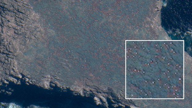
Scientists in New Zealand are using high-resolution images from DigitalGlobe’s WorldView-3 satellite to gauge the numbers of Northern Royal albatrosses, an endangered animal that nests almost exclusively on some rocky sea-stacks close to New Zealand’s Chatham Islands....
Tuesday, May 9th, 2017
Areas near the equator are frequently cloudy, obscuring the view of Earth’s surface from space. April 7, 2017, was no different. On that day, the Moderate Resolution Imaging Spectroradiometer (MODIS) on NASA’s Terra satellite captured this natural-color...
Tuesday, May 2nd, 2017
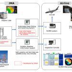
In April 2017, the Airport Low-level Wind Information (ALWIN) system, jointly developed by the Japan Meteorological Agency (JMA) and the Japan Aerospace Exploration Agency (JAXA), started operations at Tokyo International Airport (Haneda) and Narita International Airport. ALWIN...

Tuesday, April 18th, 2017
NASA recently released new global nighttime images of the Earth, including a detailed view of India and its surroundings that show how patterns of human settlement changed across the country between 2012 and 2016. Satellite images of...

Tuesday, April 18th, 2017
Successful drone entrepreneur Petr Lněnička went from award-winning filmmaker to drone inspection leader in his native Czech Republic. Here he lays out 3 pieces of advice and explains why for him, the transition seemed logical, and why...

Tuesday, April 11th, 2017
Satellite radar scans of the 7.8-magnitude Nov. 14, 2016, earthquake in New Zealand are changing the way scientists think about earthquake hazards in regions where Earth’s tectonic plates meet. The quake struck near the town of Kaikoura...
Monday, April 3rd, 2017
Earth-i is following up its successful tender award from the Government of Queensland by supporting the International Symposium on Digital Earth & Locate 17 Conference being held in Sydney, Australia, from April 3-6, 2017. The Queensland Department...
Tuesday, March 28th, 2017
Advances in spatial technology that enable digital agriculture, including a next-generation national positioning system and real-time monitoring of soil moisture levels from space, will take center stage in April 2017 at the International Symposium on Digital Earth...
Tuesday, March 21st, 2017
Japan launched a new spy satellite into orbit on March 17, 2017, to help keep an eye on its nuclear-armed neighbor, North Korea. The Information Gathering Satellite (IGS) Radar 5 lifted off atop a Japanese H-IIA rocket...

Tuesday, March 14th, 2017
If a two-year trial of Satellite Based Augmentation Systems (SBAS) being undertaken with the backing of the Australian and New Zealand governments proves successful, position fixing could become more precise than the several-meters accuracy provided by Global...