Asian Surveying & Mapping
Breaking News
Australia’s Gilmour Space Technologies ready to launch maiden Eris Test flight the nation’s first orbital launch in over 50 years
Gilmour Space Technologies is the leading launch services company...
Korea’s space agency seeks revision of plan to modify next-gen rockets into reusable system
South Korea's aerospace agency said on Thursday that it...
UAE Space Agency Signs Agreement With Technology Innovation Institute to Execute the Emirates Mission to the Asteroid Belt’s Lander Project
In the presence of His Highness Sheikh Hamdan bin...
Private Japanese lunar lander enters orbit around moon ahead of a June touchdown
A private lunar lander from Japan is now circling the moon, with...
Indian astronaut to travel soon to ISS as part of ISRO-NASA Mission
Prime Minister Narendra Modi said by 2040, an Indian’s...
China issues regulatory framework to support direct-to-device satellite services
HELSINKI — China has released comprehensive regulations for direct-to-device...
Astranis clinches $115 million Taiwan deal despite satellite setback
TAMPA, Fla. — Astranis has signed a $115 million...
UAE and Egypt Strengthen Space Collaboration with New MoU
In a milestone development for Arab space collaboration, the...
Seoul launches 4th spy satellite to boost North Korea surveillance
South Korea’s military now operates an increasingly integrated cluster...
Indonesia seeks space defense cooperation with Japan’s military
Jakarta (ANTARA) - The Ministry of Defense of Indonesia...

Feature

image

Thursday, March 24th, 2011

Geophysical Activity Leads to Geospatial Technology Use

Geophysical activity around the globe results in a need to monitor the earth's physical activity closely. Earthquakes, volcanoes and geological investigations are all monitored so internal and surface activities can be studied, understood and even modeled. Recent...
Thursday, March 17th, 2011

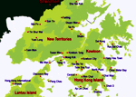
Cadastre and Cadastral Survey History of Hong Kong

Hong Kong has a long history of mapping and surveying since the beginning of the colony. This history dates back as far as the Qin (221-206 B.C.) and Han (206 B.C. - 220 A.D.) dynasties. Initial land...

Thursday, March 17th, 2011

Next Generation Handheld Field Data Computing

Handheld field data gathering devices have rapidly advanced with new innovations. These hardware devices not only record field data, they augment spatial data gathering operations and workflows throughout the organisation. Next generation field data gathering supports gathering...

Friday, March 11th, 2011

8.9 Magnitude Earthquake Off Coast of Japan

An 8.9 magnitude earth earthquake has struck off the coast of northern Japan. The earthquake has generated a 10 m high tsunami that is reportedly extending a kilometer inland in some locations. Japan sits atop one of...

Friday, March 11th, 2011

China Information Technology Has Banner Year, Led by GIS Sales

China Information Technology, Inc. (Nasdaq: CNIT) has reported a banner year with a 62% increase in revenue and a 39% increase in profit, largely led by an increase of 43% in its GIS segment. The company specializes...

Thursday, March 10th, 2011

Are We Too Dependent On GPS?

A recently released report in London suggested this past week that society has become too dependent on GPS - the technology that allows us to navigate and perform positioning guidance through the use of satellites. I seriously...

Thursday, March 3rd, 2011

Pending Land Swap Between India and Bangladesh May Move Forward

There is talk that a long-awaited land swap between India and Bangladesh may take place when India's prime minister Manmohan Singh visits Bangladesh later this year. The land along its northern border has been in dispute since...

Thursday, March 3rd, 2011

Remote Sensing for Asian Volcano Monitoring

The Korean Meteorological Association has initiated an effort to monitor volcanic activity on Mt. Baekdu on the North Korea-China border. Using the recently launched Cheollian weather satellite, the mountain will be monitored regularly through the use of satellite...

Thursday, March 3rd, 2011

National Digital Mapping – From The Bottom Up

The concept of a national map has been under review in many countries for quite a while. But the value of such a map has only recently become sharpened, clearer and more in focus. Such national maps...

Thursday, February 24th, 2011

Japan’s Space Contributions Helping the World

In a recent interview Keiji Tachikawa - President, Japan Aerospace Exploration Agency (JAXA) spoke about the many contributions that Japan is making in terms of space exploration and satellite imaging and sensing. These include an asteroid explorer that...

Page 45 of 56 1 40 41 42 43 44 45 46 47 48 49 50 56