Fear is a great motivator, but informed decisions depend upon accurate information. The Japanese food supply and water network is now under scrutiny as consumer fears, both locally and outside Japan, are struggling to understand what is happening with the safety of the food supply.
Recent indications do show that some of the food production is impacted and the water systems around the damaged sites and nearby Tokyo are also impacted.
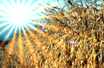
A digital food production system that begins with digital topographic and other landscape records pertaining to food growing areas is no longer only a farm producer perspective. Precision Farming extends well beyond the gate to include groundwater, disease monitoring and insect infestations. Individual farm records that tie digitally, to broader local and regional records are an important step toward supporting a safe and responsive public food production system.
GNSS has an important role in this regard because many of the agricultural production techniques and operations are now already available – although not in use every place. From the farm to the food store, digital records that help to understand the production methods and processes, linked to consumer activities, would be an invaluable step toward safeguarding the food supply in many places.
People want to know not only what is in their food – quality wise – but they also want to know the safety net that supports that production.
If agricultural production based upon accurate locations, with digital records were in place, then the baseline for the food chain could be established and monitored. Work in Melbourne, Australia at the Eco-Innovation Lab supports these kinds of approaches.
“This subject explored a variety of urban agriculture models with regards to sustainability. Much of the coursework involved mapping – mapping the distance food traveled, mapping food growing in neighbourhoods and ultimately, mapping the input and outputs of selected urban agriculture models whilst suggesting ways to incorporate sustainability into current practices, ” the project VEIL states.
In practice, the surveying, agricultural and remote sensing communities have a large responsible and important role to play in these efforts, since many consumers may have little or no understanding of how these systems can be developed.
