Asian Surveying & Mapping
Breaking News
Astranis clinches $115 million Taiwan deal despite satellite setback
TAMPA, Fla. — Astranis has signed a $115 million...
UAE and Egypt Strengthen Space Collaboration with New MoU
In a milestone development for Arab space collaboration, the...
Seoul launches 4th spy satellite to boost North Korea surveillance
South Korea’s military now operates an increasingly integrated cluster...
Indonesia seeks space defense cooperation with Japan’s military
Jakarta (ANTARA) - The Ministry of Defense of Indonesia...
China Launches 3 Astronauts To Its Space Station
The spacecraft Shenzhou-20 and the crew lifted off atop...
Former Isro chairman K Kasturirangan dies in Bengaluru at 84
Dr. Kasturirangan led the Isro, the Space Commission, and...
South Korea is converting an abandoned coal mine into a moon exploration testing ground
South Korea is transforming abandoned coal mines into testing...
ISRO to Launch Chandrayaan-5 With Japan, Plans Space Station
Dr. V. Narayanan, Chairman of the Indian Space Research...
Russia and China are threatening SpaceX’s Starlink satellite constellation, new report finds
SpaceX's Starlink satellite constellation is facing threats from Russia...
China and Pakistan agree to fly 1st foreign astronaut to Chinese space station
For the first time, the Chinese space program will train...

Feature

image

Friday, October 29th, 2010

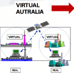
Australia Embarks on an Effort to Build Virtual Australia Print

The idea of Virtual Australia is to build a fully interoperable interactive 3D photo-realistic simulation of the natural and built environment on all scales down to 2cm, including internal spaces and...

Friday, October 29th, 2010

GPS Handhelds Support Green Initiatives for the City of Shanghai

Over the past several years, City of Shanghai leaders have been focusing their efforts on creating a greener and more sustainable city. Being awarded the World Expo 2010 event was even...

Thursday, October 28th, 2010

India Touts the Role of Space Technologies for Natural Resource Management

Dr. Kasturirangan, the chairman of the Indian Space Research Organization (ISRO), spoke this week at the inaugural National Seminar on Management of Natural Resources and Environment. He emphasized the important role of space technologies for natural resource...

Friday, October 22nd, 2010

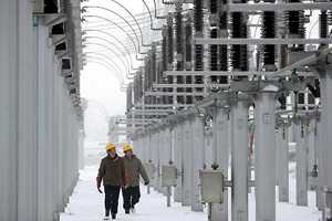
Central Southern China Power – 2D to 3D Design

Central Southern China Power Institute presented at the recent Be Inspired 2010 Conference this week in Amsterdam. The institute employs 1400 people and 80 engineers. It has completely advanced the construction processes for many substations, moving from...

Friday, October 15th, 2010

Extending Spatial Software to Decision Making

Traditionally the spatial information sector has been very good at collecting geodata and processing it. The number and types of different sensors has grown from digitization to aerial imagery and now includes integrated sensors that are able...

Friday, October 1st, 2010

GIS As Appropriate Technology: Health Mapping in Remote Eastern Indonesia

The rural population of eastern Indonesia generally has limited access to health services due to rugged topography, poor roads and limited health resources. Moreover there are often no comprehensive audits of health infrastructure resulting in poor coordination...

Friday, September 24th, 2010

Evolution of Conservation Area Land Management

Conservation area land management is gaining wider asoption throughout Asia as the stress of development places greater pressure on natural resources. This relationship is not necessarily unilateral, conservation of quality water,...

Friday, September 17th, 2010

Can We Build ‘Geospatial-Geomatic Screens’ for Disaster Mitigation?

The ability to provide disaster mitigation relies upon the experiences of many people around the globe. These past experiences have included many observations, approaches and included different technological applications to further...

Friday, September 10th, 2010

Who Owns the Surveying – GIS – CAD – Sensor – Model?

The ownership of equipment has been easy to determine. And the same can be said for spatial information as well. Even employees working on problems and developing spatial solutions are paid...

Friday, September 10th, 2010

The Move Toward Intelligent Infrastructure Promises Geospatial Advancements

The concept of intelligent infrastructure involves the combination of sensors, network connectivity and software to monitor and analyze the inputs for more efficient operations. This concept meshes nicely with advancements in...

Page 49 of 55 1 44 45 46 47 48 49 50 51 52 53 54 55