Asian Surveying & Mapping
Breaking News
HAL to build, market Isro’s SSLV in landmark deal
New Delhi, Jun 20: In a historic move for...
Taiwan developing space capabilities for all-weather imaging
TAIPEI (TVBS News) — Taiwan is advancing its space...
Honda hails successful test of reusable rocket as it looks to get into the space business
Tokyo — Japan's second-biggest carmaker, Honda, has successfully tested...
China’s space program provides larger platform for broader international cooperation
BEIJING -- Experts from China's manned space program said...
India To Launch $1.5 Billion Joint Earth Mission With NASA In July
National Aeronautics and Space Administration (NASA) and the Indian...
Axiom-4 mission delayed again: ISRO confirms Subhanshu Shukla’s ISS spaceflight won’t launch before 22 June 2025
The Axiom-4 mission to the International Space Station has...
Mengzhou spacecraft for China’s moon-landing mission passes landmark test flight
China has completed the inaugural test flight of its...
Space application for ITMA Asia + CITME 2026 opens
Shanghai – Space application for the 2026 edition of...
Yanmar, Chia Tai and XAG Empower Thai Agriculture through Innovation
Bang Nam Priao District, Chachoengsao Province, Thailand – On...
bitsensing Signs MOU with IKIO Technologies to Advance AI-Based Traffic Monitoring on India’s Expressways, Highways and Municipal Areas
Backed by proven success in South Korea and Europe,...

Feature

image

Thursday, August 25th, 2011

Australian Carbon Farming Law – Need For Precision Farming

The Australian government passed new laws to support carbon farming. The Carbon Farming Initiative is aimed at reducing the loss of carbon from farms and forests.  Agricultural production can serve to mitigate the loss of carbon into...
Wednesday, August 24th, 2011

Finding the Source: Brahmaputra, Indus, Salween and Irrawaddy Rivers

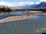
The source of the Brahmaputra, Indus, Salween and Irrawaddy rivers was reported this week from scientists at the Chinese Academy of Sciences (CAS). Using satellite imagery, Liu Shaochuang, a researcher with the Institute of Remote Sensing Applications at CAS reported...
Friday, August 19th, 2011

Existing Coastal Radar Detected Japan Tsunami

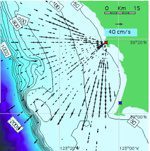
To date, tsunami detection and warning systems have been based on deep-water, pressure-sensor observations that determine changes in sea surface elevation and fluctuation on the coast, which are point measurements. Researchers observed after-the-fact that existing coastal current...
Friday, August 19th, 2011

RASAT Earth Observation Satellite Puts Turkey in Space

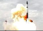
Turkey successfully launched the RASAT earth observation satellite this week. RASAT is a microsatellite imaging mission of TUBITAK-UZAY (Scientific and Technological Research Council of Turkey). It is expected that the satellite will help to provide information for disaster...
Thursday, August 18th, 2011

Asia – The Rise of Geospatial Tools Meeting Earthquake Challenges

The use and application of geospatial tools and technologies has rapidly expanded throughout Asia recently. Major events in Japan, Pakistan, New Zealand and China have given rise to a growing awareness that geospatial and geomatics technologies can...

Thursday, August 11th, 2011

New Zealand Embarks on Four-Year, $4 Million Mapping Programme

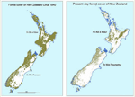
The government of New Zealand has announced a research programme today to use satellite imagery and geospatial mapping to map forests, pastures, rivers and cities across the country. The four-year Land Cover Research Programme was launched with...

Thursday, August 11th, 2011

BIM Advantages Now in Demand

Building Information Modeling (BIM) provides many benefits. An increasing number of projects are now demanding BIM inclusion as the advent of new modeling and design technologies are coupling survey quality data into them, often providing 3D capabilities....

Thursday, August 11th, 2011

Land Use Planning and Growth

Land use planning forms the basis for sustainability and development. Several locations throughout Asia are involved in developing land use plans across local to national scales. Participation in these plans is a key aspect for improving their...

Wednesday, August 3rd, 2011

The GLONASS Budget Needed to Support GNSS

The Russian Space Agency is presenting a request to the government to increase the level of funding to the agency. The request is interesting because of the information included, but also draws a line in the sand...

Tuesday, July 26th, 2011

What Does An Integrated Geospatial Strategy Mean?

From surveying to mapping to earth observation, technologies are continually changing. At the same time, regulations and laws are continually evolving. Meanwhile, financial budgets are fluctuating and the the demands of partners and the public are fluctuating....

Page 40 of 56 1 35 36 37 38 39 40 41 42 43 44 45 56