Feature
Thursday, June 2nd, 2011
The Russian GLONASS navigation satellite constellation has high-level politcal and monetary support, with 4.7 billion dollars invested over the past decade. Russia is on pace to accelerate GLONASS satellite launches for full global coverage capacity by the...
Thursday, May 26th, 2011
Fully 70% of the world is covered by water. It has been said that we know more about the moon, than we do about the oceans. Recently Hawkes Ocean Technologies won recognition from CAD software company Autodesk for...

Thursday, May 26th, 2011
China this week indicated that improved development of surveying and geographic based data systems such as GIS are integral to the future economic development of that country. The Chinese Vice Premier pointed to the need for more...

Friday, May 20th, 2011
The Mekong River runs across the Asian continent through one country after another travelling a distance of 4,200 km from beginning to end. The river is managed in a unique way, owing to the Mekong River Commission...

Friday, May 20th, 2011
Trimble Navigation’s Christchurch, New Zealand office was gutted by an overnight fire early this week. It took 40 firefighters to control the fire, and several were injured when a floor collapsed. The structure had been lightly damaged...

Thursday, May 12th, 2011
Many organizations are considering to move from 2D to 3D operations. This trend is the result of several factors including newly developed technologies, improved computer performance, 3D software innovations and changes in cost structures. Several users report...
Thursday, May 12th, 2011
During the past week Cambodia and the United Nations met together to discuss issues related to land degradation and desertification. Cambodia is a signatory to the United Nations Convention to combat Decertification (UNCCD) and the country currently 30 projects...
Friday, May 6th, 2011
Recently India launched the Resourcesat-2 satellite, a satellite designed to provide detailed information about the earth's resources and surface - a 'global workhorse' as R.R. Navalgund, Director, Space Applications Centre (SAC), Ahmedabad said. Meanwhile, this week has...

Thursday, May 5th, 2011
Around the globe today we can find many geospatial resources connected to geographic information systems (GIS) and general map making-cartography provided to junior grade education classes. But that is not the case for surveying, GNSS and other...
Thursday, April 28th, 2011
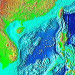
The South China has been reported to contain nearly 50 billion tons of crude oil and 20 trillion meters of natural gas. The area remains largely unexplored - and untapped. That is due to many political, technological...


