Asian Surveying & Mapping
Breaking News
HAL to build, market Isro’s SSLV in landmark deal
New Delhi, Jun 20: In a historic move for...
Taiwan developing space capabilities for all-weather imaging
TAIPEI (TVBS News) — Taiwan is advancing its space...
Honda hails successful test of reusable rocket as it looks to get into the space business
Tokyo — Japan's second-biggest carmaker, Honda, has successfully tested...
China’s space program provides larger platform for broader international cooperation
BEIJING -- Experts from China's manned space program said...
India To Launch $1.5 Billion Joint Earth Mission With NASA In July
National Aeronautics and Space Administration (NASA) and the Indian...
Axiom-4 mission delayed again: ISRO confirms Subhanshu Shukla’s ISS spaceflight won’t launch before 22 June 2025
The Axiom-4 mission to the International Space Station has...
Mengzhou spacecraft for China’s moon-landing mission passes landmark test flight
China has completed the inaugural test flight of its...
Space application for ITMA Asia + CITME 2026 opens
Shanghai – Space application for the 2026 edition of...
Yanmar, Chia Tai and XAG Empower Thai Agriculture through Innovation
Bang Nam Priao District, Chachoengsao Province, Thailand – On...
bitsensing Signs MOU with IKIO Technologies to Advance AI-Based Traffic Monitoring on India’s Expressways, Highways and Municipal Areas
Backed by proven success in South Korea and Europe,...

Features

image

Friday, October 21st, 2011

QZSS Multi-GNSS Experiment for Asia-Oceania

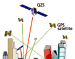
The Quasi-Zenith Satellite System (QZSS) is a constellation of multiple satellites, with at least one satellite positioned near zenith over Japan at anytime. The purpose of the system is to enable improved satellite coverage, thereby enhancing the...

Thursday, October 20th, 2011

Mitsubishi Aims for a Smarter Grid in Japan

The term Smart Grid conjures up many impressions. To the Mitsubishi company it means innovation and revolution within Japanese households. The company expects to generate over a trillion yen within 5 years through products integrated to transform...
Thursday, October 20th, 2011

Borneo Rainforest Monitoring Tool Wins GMES Prize

The European Union's Global Monitoring for Environment and Security (GMES) programme has recently concluded their GMES Ideas Challenge, which awards prizes to the best applications for new uses of earth observation images. The overall winner of this...

Thursday, October 13th, 2011

C-NAV Delivers Precise GNSS Performance

C-NAV is an international surveying and mapping firm that aims to provide high-accuracy GNSS positioning solutions to the offshore and hydrographic surveying community. The company is involved in seismic exploration, land surveying and flood mapping, geotechnical engineering and a...

Wednesday, October 12th, 2011

India Launches the Megha-Tropiques Earth Observation Satellite

The Indian Space Research Organisation (ISRO) successfully launched the Megha-Tropiques satellite, along with three micro satellites, aboard their Polar Satellite Launch Vehicle today. The Megha-Tropiques earth observation satellite is an Indo-French Joint Satellite Mission that will study...

Wednesday, October 12th, 2011

Japan Proves a Hotbed for Location-Based Services Growth

Location-based services has been an emerging market for more than ten years, with projected explosive growth worldwide that hasn't matched the hype. While new check-in services, such as Gowalla and Foursquare, were seen as a driver for...

Tuesday, October 11th, 2011

The Continuing Evolution of 3D Cadastre in Asia

Continuing discussion and technological advances with respect to 3D cadastre are changing how cadastre are stored and used. By comparison, 2D cadastre have several disadvantages that updated and improved 3D products and services can provide. Both Nepal...

Friday, October 7th, 2011

Interview: Trimble’s Unified Geospatial Division Sets the Pace

A series of acquisitions and a new unified purpose within Trimble's GeoSpatial Division have caught the eyes of many. Mobile mapping, aerial imaging, photogrammetry and laser scanning are now integrated toward a common goal. With a capability to...

Friday, October 7th, 2011

Laser Scanning – Advancing 3D

Laser scanning has become increasingly popular from both airborne and terrestrial perspectives. New products are advancing the options for use and enabling the collection of 3D data from varied environments. This poses new challenges, but also solves...

Friday, October 7th, 2011

New HabiMAP Tool Factors Development Impacts to Marine Environments

The Perth, Australia office of international professional and environmental services firm AECOM has developed an new tool to assess the risks to critical marine habitats from development. HabiMAP provides new survey techniques to map and assess animals,...

Page 38 of 57 1 33 34 35 36 37 38 39 40 41 42 43 57