Asian Surveying & Mapping
Breaking News
Outsight Expands into Asia-Pacific with a New Hong Kong Office to Propel the Deployment of of It’s 3D Lidar Software
Following its recent expansion across Europe with the establishment...
Hexagon and Hitachi Zosen sign agreement to provide TerraStar-X Enterprise corrections in Japan
Calgary, Canada – Hexagon’s Autonomy & Positioning division and Hitachi...
China launches “Macao Science 1” space exploration satellites
JIUQUAN, May 21 (Xinhua) -- China successfully sent two...
Isro’s Chandrayaan-3 launch likely on July 12
The Indian Space Research Organisation is expected to launch...
SpaceX sends Saudi astronauts, including nation’s 1st woman in space, to International Space Station
Saudi Arabia’s first astronauts in decades rocketed toward the...
Singapore Tourism Board partners with Google to create Augmented Reality tours
Google’s ARCore and the Singapore Tourism Board (STB) launched...
India’s New Space Policy Allows Full Private Sector Involvement
Long dominated almost exclusively by the government, the Indian...
Bayanat, Yahsat and ICEYE announce an ambitious program to broaden commercial opportunities across the UAE space-ecosystem
The program aims to develop a constellation of five LEO...
International Code Council and Dubai Municipality Sign Memorandum of Understanding to Promote Safe, Innovative Construction
The collaboration supports the position of the Emirate of...
Malaysian Space Agency receives Geospatial World Excellence Award for use of technology in monitoring rice crops
KUALA LUMPUR, May 7 — The Malaysian Space Agency...
pslv-launch

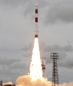
The Megha-Tropiques was launched in a low Earth orbit between 25 degrees North and 25 degrees South latitude at an altitude of 865 kilometers, inclined 20 percent relative to the equator. This vantage point will keep the satellite above the tropical belt to study humidity profiles, cyclones and flooding in the tropical zone. The orbit also keeps the satellite from flying over the French mainland, which is perhaps a first for a mission-funding country.

There are four instruments aboard the satellite:

  • Scanning microwave imager for detection of rain and atmosphere structures, developed jointly by CNES and ISRO
  • Sounder for probing vertical profiles of humidity from CNES
  • Scanner for radiation budget from CNES
  • Radio occultation sensor for vertical profiling of temperature and humidity, developed by Thales Alenia Space of France and Italy

Funding for the operation was split between ISRO (60% or Rs 90 crore) and CNES (40%), with an approximately total $98 million budget. This observation mission is just the second to to look at tropical climate globally, following on the NASA and Jpan joint mission of 1997. The mission is expected to last from three to five years time.

The three micro satellites that were launched alongside Megha-Tropiques include:

  • Jugnu- an Indian Institute of Technology-developed satellite designed to test a camera system that captures imagery in near infrared, along with evaluation of a GPS receiver and Inertial Measurement Unit (IMU) used for satellite navigation
  • SRMSat – a nanosatellite developed by students and faculty of SRM University that will monitor Carbon dioxide and water vapor using a spectrometer
  • VesselSat-1 – a microsatellite that carries the Automatic Identification System for ships, detecting signals from vessels at sea

You can watch a launch video here.