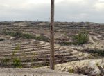

The Earth Watchers application has harnessed a worldwide audience of young people that act as agents to monitor the rainforest through web-based GIS and current satellite images. Using these tools, the agents pull together detailed reports of their findings to share with their peers. The application provides a fun way to learn about the application of GIS and remote sensing technology, while giving students a global cause of imprtance as motivation.
“Many people are worried about the condition of the rainforest here and would like to make a contribution to finding a solution,” said Eduardo Dias, director of Geodan Southeast Asia. “With our project, we make it possible for everyone to take action themselves. This way, people are part of the solution and, using the Earthwatchers application, they are able to see for themselves what is happening.”
DeforestACTION is a worldwide action plan designed to help save the rainforest in Borneo. They worked with Geodan, a geo-ICT consulting firm based in the Netherlands, to create the specialized tool.
The main objectives of this project are to:
In additon to the worldwide crowdsourcing effort, there are local teams that will survey the top ten most confirmed sites every week. With proof of illegal activities, they can then form outreach to local communities and the government to enforce the law and put a stop to illegal logging.