Asian Surveying & Mapping
Breaking News
Australia’s Gilmour Space Technologies ready to launch maiden Eris Test flight the nation’s first orbital launch in over 50 years
Gilmour Space Technologies is the leading launch services company...
Korea’s space agency seeks revision of plan to modify next-gen rockets into reusable system
South Korea's aerospace agency said on Thursday that it...
UAE Space Agency Signs Agreement With Technology Innovation Institute to Execute the Emirates Mission to the Asteroid Belt’s Lander Project
In the presence of His Highness Sheikh Hamdan bin...
Private Japanese lunar lander enters orbit around moon ahead of a June touchdown
A private lunar lander from Japan is now circling the moon, with...
Indian astronaut to travel soon to ISS as part of ISRO-NASA Mission
Prime Minister Narendra Modi said by 2040, an Indian’s...
China issues regulatory framework to support direct-to-device satellite services
HELSINKI — China has released comprehensive regulations for direct-to-device...
Astranis clinches $115 million Taiwan deal despite satellite setback
TAMPA, Fla. — Astranis has signed a $115 million...
UAE and Egypt Strengthen Space Collaboration with New MoU
In a milestone development for Arab space collaboration, the...
Seoul launches 4th spy satellite to boost North Korea surveillance
South Korea’s military now operates an increasingly integrated cluster...
Indonesia seeks space defense cooperation with Japan’s military
Jakarta (ANTARA) - The Ministry of Defense of Indonesia...

Features

image

Thursday, September 29th, 2011

Tunnelling: From Surveying to Data Management

Tunnelling has gone high-tech. Integrating survey data, monitoring information, data management and collaborative interaction, tunnelling is a shared effort and technologies are increasingly being integrated toward common web-based management systems. As tunnels proceed, machinery wear, alignment, shift...

Friday, September 23rd, 2011

Satellites Follow Typhoon Roke Up Close


Typhoon Roke came ashore in Japan this week causing considerable damage and several deaths. Beginning as a tropical depression 1370 km south of Japan in the Philippine Sea ten days previous, the storm ranged from a Category...
Friday, September 23rd, 2011

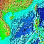
Will New Mapping Effort Ease Tensions in the South China Sea?

The Philippines is urging a meeting between the 10-member Association of South-East Asian Nations (ASEAN) and China to clearly map disputed areas in the South China Sea in order to reduce tensions. The meeting of ASEAN Maritime...
Thursday, September 22nd, 2011

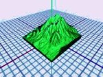
3D Printers – Helping Your Mind to See What Your Eyes Do

As the world of 3D expands and grows, the role of the printer is adapting to meet the challenge. While most 3D spatial data is usually maintained within a digital environment and managed within software, a 3D...

Friday, September 16th, 2011

IBM’s Chinese Lab Takes on Internet of Things

The Internet of Things holds great promise with more objects and systems interconnected and available for query and data collection through Internet connectivity. IBM is leading the way with much of this development in a smarter city...
Thursday, September 15th, 2011

Indonesian Memorandum for Geospatial Data Signed

In Indonesia the signing of a Memorandum of Understanding between the Coordinating Agency for Surveys and Mapping Agency (RAN) with the National Archives of the Republic of Indonesia (ANRI) took place this week. The scope of this cooperation...

Thursday, September 15th, 2011

Seabed Mapping and Surveying in Asia

Earlier this week, China announced that it will increase it's level of seabed mapping and surveying. These operations aim to describe seabed geology, water depths and the location of features and objects. Surveying of the waters and...

Thursday, September 8th, 2011

Mobility Tools Support Infrastructure Design

The use of mobility tools and technologies is rapidly innovating and underpins the development of new design work flows from the office to construction sites and operators information systems. Continuous data gathering, exchange and update operations are...

Thursday, September 8th, 2011

Singapore Urban Development Authority Wins URISA Award

Singapore's Urban Redevelopment Authority (URA) has won the prestigious Exemplary Systems in Government (ESIG) award from the Urban and Regional Information Systems Association (URISA). The URA Digital 3D Urban Model System garnered praise because it was built...

Thursday, September 8th, 2011

Mapping Oceanographic Current in the Northwest Pacific

Monitoring and mapping of oceanographic currents helps in understanding the movement of contaminants in ocean waters and estimating the impacts of climate change and to provide faster sea ship routes. The Korea Hydrographic and Oceanographic Administration has recently...

Page 39 of 57 1 34 35 36 37 38 39 40 41 42 43 44 57