Asian Surveying & Mapping
Breaking News
UAE and Egypt Strengthen Space Collaboration with New MoU
In a milestone development for Arab space collaboration, the...
Seoul launches 4th spy satellite to boost North Korea surveillance
South Korea’s military now operates an increasingly integrated cluster...
Indonesia seeks space defense cooperation with Japan’s military
Jakarta (ANTARA) - The Ministry of Defense of Indonesia...
China Launches 3 Astronauts To Its Space Station
The spacecraft Shenzhou-20 and the crew lifted off atop...
Former Isro chairman K Kasturirangan dies in Bengaluru at 84
Dr. Kasturirangan led the Isro, the Space Commission, and...
South Korea is converting an abandoned coal mine into a moon exploration testing ground
South Korea is transforming abandoned coal mines into testing...
ISRO to Launch Chandrayaan-5 With Japan, Plans Space Station
Dr. V. Narayanan, Chairman of the Indian Space Research...
Russia and China are threatening SpaceX’s Starlink satellite constellation, new report finds
SpaceX's Starlink satellite constellation is facing threats from Russia...
China and Pakistan agree to fly 1st foreign astronaut to Chinese space station
For the first time, the Chinese space program will train...
ISRO’s “Space on Wheels” offers a peek into Indian Space Programme to students in Karimnagar
The Indian Space Research Organisation (ISRO)’s “Space on Wheels”...

Features

image

Thursday, March 22nd, 2012

Mapping Matters: From Disasters to H1N1

Mapping plays an important role during disaster and disease outbreaks. The city of Pune in India is experiencing an outbreak of H1N1 influenza this week, and mapping is being employed to meet the challenge. At the same...
Wednesday, March 21st, 2012

First Civilian Photogrammetric UAV Flight Over Singapore

For the first time Singaporean authorities have given permission for a photogrammetric UAV mapping/modeling flight over an important area of the city. In the context of the SEC-FCL (Future Cities Laboratory) project a pilot study is conducted...

Thursday, March 15th, 2012

Water at the Crossroads: Measure – Monitor – Map

Water is a valuable and important resource. Spatial data for water resources is captured through many kinds of map, imaging, surveying and other measurement tools. This data is used to monitor and understand these resources, and is...

Thursday, March 15th, 2012

Fourth Digital Earth Summit Scheduled for Wellington this September

The Digital Earth Summit will convene for the fourth biannual event from Sept. 2-4, 2012 in Wellington, New Zealand. This event is sponsored by both the Wellington City Council and Land Information New Zealand and coordinated by...
Friday, March 9th, 2012

Mapping the Japan Tsunami Disaster in 3D

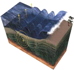
The Japan Tsunami disaster resulted in a proliferation of mapping and cartographic production. This resulted from the many needs of people to identify and provide emergency services, to enable protective services, assist in geophysical studies and to...

Friday, March 9th, 2012

Australia Floods Call Geospatial Technology to Action

Australia is once again experiencing flooding and it is expected that flooding will result in nearly $1 billion of damage. Although waters have receded in some places, more rains are expected over the next few days and...

Thursday, March 8th, 2012

Bhutanese Foresters Training on GIS with U.S. Forest Service

The mountainous kingdom of Bhutan, whose economy relies heavily on agriculture and forestry, began an ambitious National Forest Inventory project in 2010 to capture comprehensive data on forest cover and resources. The country's supreme law maintains that...

Thursday, March 1st, 2012

Considerations for Aerial and UAV Imagery

Digital airborne cameras have been available on the market for use globally for many years, Without doubt they provide high quality results, have nurtured and created capacity for supporting information gathering through to processing and distribution. By...

Thursday, March 1st, 2012

South Korea Launches Space Weather Services

Solar flares and other space phenomenon can quickly impact communications, electronic systems and GNSS operations on earth. The South Korean government has initiated a new space weather system that will provide up-to-date information about space weather for...

Friday, February 24th, 2012

How Cartographers Make Surveyors Look Good

Surveyors are experts at collecting spatial data with high accuracy and precision. But cartographers are masters when it comes to making maps and graphic products that represent surveying information. For users of cartographic products though, how the...

Page 33 of 57 1 28 29 30 31 32 33 34 35 36 37 38 57