Asian Surveying & Mapping
Breaking News
South Korea is converting an abandoned coal mine into a moon exploration testing ground
South Korea is transforming abandoned coal mines into testing...
ISRO to Launch Chandrayaan-5 With Japan, Plans Space Station
Dr. V. Narayanan, Chairman of the Indian Space Research...
Russia and China are threatening SpaceX’s Starlink satellite constellation, new report finds
SpaceX's Starlink satellite constellation is facing threats from Russia...
China and Pakistan agree to fly 1st foreign astronaut to Chinese space station
For the first time, the Chinese space program will train...
ISRO’s “Space on Wheels” offers a peek into Indian Space Programme to students in Karimnagar
The Indian Space Research Organisation (ISRO)’s “Space on Wheels”...
Geospatial led solutions build the foundations for better decision-making
Geo Connect Asia 2025 paves the way for turning...
GEOSA, Singapore Land Authority Launch Achievements of Joint Geospatial System Project
Riyadh, SPA -- The General Authority for Survey and...
Building in Bangkok collapses as powerful earthquake hits southeast Asia
One person has died and 50 were injured in...
Bellatrix Aerospace Partners with Astroscale Japan for Space Debris Removal
Bellatrix Aerospace, a Bengaluru-based space mobility company, has joined...
NSTC announces Pingtung site as Taiwan’s space mission launch center
Taipei, March 26 (CNA) Taiwan's National Science and Technology...

Features

image

Thursday, May 5th, 2011

Where Are the Workshops on GNSS / Design for School Kids?

Around the globe today we can find many geospatial resources connected to geographic information systems (GIS) and general map making-cartography provided to junior grade education classes. But that is not the case for surveying, GNSS and other...
Thursday, April 28th, 2011

South China Sea – The New Energy Location?

The South China has been reported to contain nearly 50 billion tons of crude oil and 20 trillion meters of natural gas. The area remains largely unexplored - and untapped. That is due to many political, technological...

Thursday, April 28th, 2011

National Spatial Data Infrastructure Take Root in Asia

National Spatial Data Infrastructures (NSDI) continue to expand and grow across Asia. Thailand this week has indicated that the country is aiming to initiate it's own NSDI by 2012. As with other similar projects, the goal for...
Thursday, April 21st, 2011

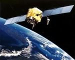
India Successfully Launches Resourcesat-2

The Indian Space Resource Organization successfully launched the remote sensing satellite Resourcesat-2 and two smaller satellites at 10:12 a.m. on Wednesday. The launch also included Singapore's first remote sensing satellite called X-Sat as well as a mini...

Wednesday, April 20th, 2011

GIS Supports Airports Around the Globe

terry_bills_and_ian_koeppelAirports are changing around the globe. New technologies and economic pressures are causing them to evaluate their operations and to become more responsive and efficient. Geographic...

Wednesday, April 20th, 2011

Philippines President Commits to 3D Map to Combat Natural Disasters

Philippine President Benigno Aquino has set asside P1 billion ($23.25 million) to create a 3D map of the entire country. The detailed map is part of an effort to guard and plan against disasters, with 66 provinces...

Tuesday, April 19th, 2011

Spatial Data – Key to Landscape Modeling

The ability to analyze, model and simulate natural disaster events and their consequences is unique to the geospatial and geomatics sector. No other tools provide data management, analysis and the associated visual output, useful for decision-making purposes...

Friday, April 15th, 2011

Measurement to Modeling – Hydrological and Meteorological Monitoring

Water is important to all living systems and the management of this valuable resource is becoming increasingly important. In addition, boundary layer measurements obtained through meteorological observation provide an integral connection to the hydrologic cycle. The range...

Thursday, April 14th, 2011

Turkish National CORS Network and Applications

thumb_turkey_corsRecently, a national CORS network, called CORS-TR network has been established by Istanbul Kultur University in Turkey and Northern Cyprus. The project was sponsored by the...

Friday, April 8th, 2011

Datums, Projections and Measurement with Earthquakes

The average person working with geospatial data knows about or has heard about datums and projections. Most others have not. Try putting a Canadian datum and coordinate system (NAD83) into your field GNSS Receiver in Singapore (SVY-21)...

Page 44 of 57 1 39 40 41 42 43 44 45 46 47 48 49 57