Asian Surveying & Mapping
Breaking News
Building in Bangkok collapses as powerful earthquake hits southeast Asia
One person has died and 50 were injured in...
Bellatrix Aerospace Partners with Astroscale Japan for Space Debris Removal
Bellatrix Aerospace, a Bengaluru-based space mobility company, has joined...
NSTC announces Pingtung site as Taiwan’s space mission launch center
Taipei, March 26 (CNA) Taiwan's National Science and Technology...
ISRO-NASA mission to send Indian astronaut to ISS faces budget cut
New Delhi: The ISRO-NASA mission to send an Indian...
China launches new data relaying satellite into space
China successfully launched a new data relaying satellite into...
China unveils first homegrown space mining robot
China's first space mining robot has been developed by...
North Korea rejects G7 call for denuclearization, vows to ‘strengthen’ nuclear forces
North Korea on Monday vowed to "steadily update and...
Taiwan showcases innovative technologies at Satellite 2025
Innovative technologies are on display at the Taiwan Space...
Japanese Astronaut Onishi departs with three others for 2nd Space Mission
Takuya Onishi has left for space for his second...
Saudi Arabia, Korea Sign Memorandum of Cooperation to Enhance Space Collaboration
Riyadh, SPA: The Saudi Space Agency (SSA) today signed...
razaksat

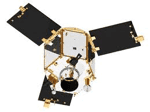
RazakSAT-2 will be run by the National Space Agency (ANGKASA) with a launch date expected in 2015. The new satellite will include updgrades to the hardware and software of the currently orbiting satellite that has captured more than 1,000 images to date.

The investment is said to improve the economic growth of the country, with job creation as well as application in vital industries such as agriculture, forestry, and fisheries. The satellite will also improve mapping and land use planning as well as coastal monitoring.

The existing RazakSAT satellite is the country’s second satellite after the original TiungSAT-1 that was launched in September 2000. RazakSAT carries a pushbroom camera with five linear detectors ( a panchromatic and four multi-spectral). The satellit achieved the intended Near-Equatorial Low Earth Orbit (NEqO) at 685 km altitude and a 9 degree inclination, giving it the ability to revisit the country every 90 minutes. The revisit rate is an important factor because the equatorial location means heavy cloud cover over the country.