Asian Surveying & Mapping
Breaking News
Thailand to launch its second Earth satellite next week
Thailand is set to launch it second Earth observation...
Chinese launch startup’s rocket fails during satellite launch
The Chinese launch company Galactic Energy suffered its first...
First Hong Kong-made satellite set to launch in November from Guangdong province, company reveals
The first Hong Kong-made satellite is set to be...
China launches Yaogan 39 remote sensing satellite
China launched a Long March 2D carrier rocket on...
Saudi Arabia publishes maps with new names for ceded islands
A new map published by Saudi Arabia’s General Authority...
US, Saudi Arabia conclude region’s largest-ever counter-UAS exercise
The US and Saudi Arabia conducted the largest-ever counter-UAS exercise...
Study improves accuracy of planted forest locations in East Asia
An international team led by Purdue University scientists has...
Iran, Russia Working On Joint Research Spacecraft
In an interview with Tasnim, the president of the...
France, Bangladesh sign deal to provide loans, satellite technology during Macron’s visit to Dhaka
French President Emmanuel Macron witnessed the signature of a...
Iran, Russia Working on Joint Research Spacecraft
TEHRAN (Tasnim) – Top universities from Iran and Russia...
memorandum kari

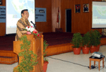
Memorandum signed by the head and head Bakosurtanal Asep Karsidi ANRI M. Menkokesra Asichin witnessed by Agung Laksono and Menristek Suharna Surapranata and the office echelon I, II, and III from both institutions.Head of the Bakosurtanal, Asep Karsidi in his speech stated that the RAN has the task to map the entire territory of Indonesia.

A second agreement was also signed on the same day that seeks to advance the use of geospatial information within the country. 

Coordinating Agency for Surveys and Mapping (RAN) and the Development and Education Command Navy (TNI-AL Kobangdikal) signed a Cooperation Agreement. 

Both institutions agreed to hold a Cooperation Agreement in the field of education, research and development of Geospatial Information. 

Conducted by Principal Secretary Penadatanganan Bakosurtanal, Ir. Budhy Andono Soenhadi Kobangdikal MCP and Commander of Navy, Rear Admiral SE Sadiman.