Asian Surveying & Mapping
Breaking News
Seoul launches 4th spy satellite to boost North Korea surveillance
South Korea’s military now operates an increasingly integrated cluster...
Indonesia seeks space defense cooperation with Japan’s military
Jakarta (ANTARA) - The Ministry of Defense of Indonesia...
China Launches 3 Astronauts To Its Space Station
The spacecraft Shenzhou-20 and the crew lifted off atop...
Former Isro chairman K Kasturirangan dies in Bengaluru at 84
Dr. Kasturirangan led the Isro, the Space Commission, and...
South Korea is converting an abandoned coal mine into a moon exploration testing ground
South Korea is transforming abandoned coal mines into testing...
ISRO to Launch Chandrayaan-5 With Japan, Plans Space Station
Dr. V. Narayanan, Chairman of the Indian Space Research...
Russia and China are threatening SpaceX’s Starlink satellite constellation, new report finds
SpaceX's Starlink satellite constellation is facing threats from Russia...
China and Pakistan agree to fly 1st foreign astronaut to Chinese space station
For the first time, the Chinese space program will train...
ISRO’s “Space on Wheels” offers a peek into Indian Space Programme to students in Karimnagar
The Indian Space Research Organisation (ISRO)’s “Space on Wheels”...
Geospatial led solutions build the foundations for better decision-making
Geo Connect Asia 2025 paves the way for turning...

Features

image

Tuesday, June 27th, 2017

JAXA Tests Snow and Ice Sensors

Demonstration tests on snow and ice monitoring sensors, led by the Japan Aerospace Exploration Agency (JAXA), have begun at Kitami Institute of Technology (Kitami, Hokkaido). For the tests, researchers have created outdoor, underground installations of the sensors...

Tuesday, June 20th, 2017

China Launches Remote-Sensing Micro-Nano Satellites

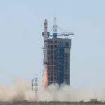
On June 15, 2017, China launched two remote-sensing micro-nano satellites on a Long March-4B rocket from Jiuquan Satellite Launch Center in northwest China's Gobi Desert. The OVS-1A and the OVS-1B, the first two satellites of Zhuhai-I remote-sensing...

Tuesday, June 13th, 2017

Satellites See Tropical Cyclone Mora Approaching Bangladesh

The geostationary satellites of EUMETSAT, JMA and NOAA acquired this image of Tropical Cyclone Mora approaching Bangladesh on Monday, May 29, 2017. Cyclone Mora struck the eastern coast of Bangladesh on May 30. The Category 1 hurricane...

Monday, June 5th, 2017

ISRO Successfully Launches GSAT-19

On June 5, 2017, the Indian Space Research Organisation (ISRO) GSLV-Mk III rocket successfully launched from the Satish Dhawan Space Centre, carrying the 3,136-kilogram GSAT-19 satellite to a geosynchronous transfer orbit. With a mission life of 10...

Tuesday, May 30th, 2017

Kolkata’s Slum Lanes Digitized for GPS

A total of 1.4 million people live in the informal settlements of the West Bengal city of Kolkata, which represents around 30 percent of the urban population. Up until recently, these residents had no addresses accessible via...

Wednesday, May 24th, 2017

China’s Satnav Industry Grows 22 Percent in 2016

The output value of China's satellite navigation and location-based service industry reached 211.8 billion yuan ($30.8 billion U.S.) in 2016, up 22.1 percent year on the year, according to an industry white paper released by the Global...

Wednesday, May 17th, 2017

Scientists Use Satellites to Count Endangered Birds in New Zealand

Scientists in New Zealand are using high-resolution images from DigitalGlobe’s  WorldView-3 satellite to gauge the numbers of Northern Royal albatrosses, an endangered animal that nests almost exclusively on some rocky sea-stacks close to New Zealand’s Chatham Islands....

Tuesday, May 9th, 2017

MODIS Satellite Captures Roll Clouds Over Pacific Atolls

Areas near the equator are frequently cloudy, obscuring the view of Earth’s surface from space. April 7, 2017, was no different. On that day, the Moderate Resolution Imaging Spectroradiometer (MODIS) on NASA’s Terra satellite captured this natural-color...

Tuesday, May 2nd, 2017

New Wind Information System Debuts at Japanese Airports

In April 2017, the Airport Low-level Wind Information (ALWIN) system, jointly developed by the Japan Meteorological Agency (JMA) and the Japan Aerospace Exploration Agency (JAXA), started operations at Tokyo International Airport (Haneda) and Narita International Airport. ALWIN...

Tuesday, April 18th, 2017

Nighttime Images Show India’s Growth

NASA recently released new global nighttime images of the Earth, including a detailed view of India and its surroundings that show how patterns of human settlement changed across the country between 2012 and 2016. Satellite images of...

Page 27 of 57 1 22 23 24 25 26 27 28 29 30 31 32 57