Features

Monday, October 9th, 2017
Water industry experts from South Australia were appointed to deliver a stormwater harvesting pilot project for the Chinese city of Jinan under the Sponge City program, which is part of AU$400 million being invested in Jinan over...

Monday, October 2nd, 2017
Although its space industry employs about 11,500 people, Australia is one of the few major developed countries to not have a space agency. But that’s about to change after a domestic industry review called for a dedicated...

Monday, September 25th, 2017
Between 1965 and 1975, the United States and its allies dropped more than 7.5 million tons of bombs on Vietnam, Laos and Cambodia—double the amount dropped on Europe and Asia during World War II. Pound for pound,...

Monday, September 18th, 2017
CSIRO’s Data61, Australia’s data innovation network, and geospatial technology company Radiant.Earth partnered to develop joint research into satellite imagery and Earth-observation data for disaster resilience in areas such as human disaster management, health, climate change and sustainable...

Monday, September 11th, 2017
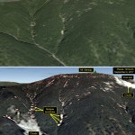
Analysts peering at satellite images of North Korea after its latest nuclear test spotted many landslides and wide disturbances at the country’s test site. Tunnels for the nuclear blasts are deep inside Mount Mantap, a mile-high peak....

Tuesday, September 5th, 2017
An emerging architectural research method is being used to document the architectural heritage of Indonesian buildings wiped out in the 2004 tsunami. Banda Aceh, on the Indonesian island of Sumatra, was one of the worst affected areas...

Tuesday, August 29th, 2017
SpaceX successfully launched FORMOSAT-5, the first fully Taiwan-made Earth observation satellite, from Vandenberg Air Force Base in California on Aug. 24, 2017, nearly four years after its original intended late-2013 launch. The 475-kilogram satellite was sent into...

Wednesday, August 23rd, 2017
The importance of having the right equipment for a job cannot be underestimated. In a surveying and mapping project, the access to advanced 3D laser scanning technology can make a world of difference to the study outcome....

Tuesday, August 22nd, 2017
The Indian government recently cleared a deal with the United States to purchase 22 MQ-9 Guardian surveillance drones. This deal, initiated last year and officially cleared in June 2017, is worth an estimated $2 billion. The Indian...

Tuesday, August 15th, 2017
South Korea has begun development of Earth-based navigation technology as an alternative to satellite-based systems to protect its ships from cyber attacks. The Earth-based navigation technology is known as eLoran, and is an upgraded version of radio...

