Asian Surveying & Mapping
Breaking News
HAL to build, market Isro’s SSLV in landmark deal
New Delhi, Jun 20: In a historic move for...
Taiwan developing space capabilities for all-weather imaging
TAIPEI (TVBS News) — Taiwan is advancing its space...
Honda hails successful test of reusable rocket as it looks to get into the space business
Tokyo — Japan's second-biggest carmaker, Honda, has successfully tested...
China’s space program provides larger platform for broader international cooperation
BEIJING -- Experts from China's manned space program said...
India To Launch $1.5 Billion Joint Earth Mission With NASA In July
National Aeronautics and Space Administration (NASA) and the Indian...
Axiom-4 mission delayed again: ISRO confirms Subhanshu Shukla’s ISS spaceflight won’t launch before 22 June 2025
The Axiom-4 mission to the International Space Station has...
Mengzhou spacecraft for China’s moon-landing mission passes landmark test flight
China has completed the inaugural test flight of its...
Space application for ITMA Asia + CITME 2026 opens
Shanghai – Space application for the 2026 edition of...
Yanmar, Chia Tai and XAG Empower Thai Agriculture through Innovation
Bang Nam Priao District, Chachoengsao Province, Thailand – On...
bitsensing Signs MOU with IKIO Technologies to Advance AI-Based Traffic Monitoring on India’s Expressways, Highways and Municipal Areas
Backed by proven success in South Korea and Europe,...
indus

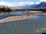
The source of the Brahmaputra, Indus, Salween and Irrawaddy rivers was reported this week from scientists at the Chinese Academy of Sciences (CAS). Using satellite imagery, Liu Shaochuang, a researcher with the Institute of Remote Sensing Applications at CAS reported the findings. Working on the expedition operating between 2007-2010, the project included both field trips and remote sensing tools and technologies.

“Previously, the sources of the four rivers were never clearly designated, and differing accounts regarding their lengths nd drainage areas confused researchers for many years due to restrictions of natural conditions and surveying and mapping technologies, said Liu Shaochuang, a researcher with the Institute of Remote Sensing Applications under the CAS,” reported Xinhua

Accomplishing this work depended upon updated remote sensing technologies. Today, satellite imagery has higher resolution and landscape features and spectral analysis often help to identify and delineate these landscape features.  

The Salween River, “is an international river, originating from Tangula Mountain of the Himalayas in the Tibetan plateau. The Salween then flows southward through Yunnan Province of China, down through Shan and Kayah States in the East of Burma (Myanmar), and along the Thai-Burma border, passing through Kayan and Mon States (Burma), and emptying into the Gulf of Martaban in the Andaman Sea,” as described by Salween Watch.