Asian Surveying & Mapping
Breaking News
Australian Space Agency funds development of aerospace-grade GNSS receiver
The Australian Space Agency has funded the development of...
Continuity risks for Australian EO data access
A new report details the widespread use of Earth...
China launches new remote sensing satellite
JIUQUAN, April 15 (Xinhua) -- China on Monday launched...
7.4-Magnitude Earthquake Strikes Taiwan
A major, 7.4-magnitude earthquake struck the eastern coast of...
Tata Deploys Its Geospatial Satellite In Space on Space X’s Falcon 9 Rocket
THIRUVANANTHAPURAM: Tata Company launched India's first private commercial satellite...
Taiwan’s Formosat-8 Satellite Set for Launch by 2025
The Taiwan Space Agency has announced progress on the...
Iranian Scientists to Build Satellite Constellation for 2 Simultaneous Missions
The scientists at the knowledge-based company had previously succeeded...
China provides geospatial intel and other military support to Russia, US says
The US has warned its European allies that China...
Japanese lunar lander company ispace raises $53.5 million in stock sale
WASHINGTON — Japanese lunar lander developer has raised $53.5...
Esri and Prince Sultan University Advance GIS Education Through Strategic Partnership
Memorandum of Understanding with Institution Enhances GIS Curriculum and...
thumb rasat_satellite

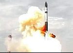
Operating from a 689 km altitude orbit, RSAT is owned and operated by TUBITAK UZAY. “It is the first remote sensing satellite that is being developed and manufactured in Turkey by Turkish engineers. The predecessor mission was BILSAT which was launched on Sept. 27, 2003, a cooperative mission of TUBITAK-BILTEN, Turkey, and of SSTL, Surrey, UK,” reported EO Portal.

The satellite is largely designed and built in Turkey by Turkish engineers. 

Turkey’s  annual rate of growth has been buoyant at 6.7% GDP. This growth has supported the planning and development of new infrastructure including dams, rivers, bridges and railways. Located at a central point between the west and east, Turkey plays a major role in the transport and planning of energy corridors throughout the region. 

RASAT is expected to open the door toward assisting in some of these projects. Large_scale earthquake and other natural hazard events are prevalent in the region, and the satellite is expected to help with efforts designed to meet those challenges.