Earthquakes create havoc. Some result in loss of life, while all of them result in physical changes created by the earth’s shifting upper surfaces. In the case of the Japan earthquake recently, the damage extended well across the Pacific Ocean underwater. Total Telcom reported on the widespread damages to fibre optic cable both on land and under the sea.
At the time it said, “While the extent of the damage to undersea cables is still unclear and financial losses unknown, operators said they are undergoing an inspection and looking to expedite restoration. Pacnet aims within five to seven days to repair two damaged segments of its East Asia Crossing network connecting Japan to other parts of Asia, like Taiwan and Hong Kong, Barney said. He played down concerns about any financial impact on Pacnet or regional telecom operators from the damaged cables.“
In 2008, a 7.9 magnitude earthquake event “affected eight provinces – Sichuan, Gansu, Shaanxi, Yunnan, Shanxi, Guizhou, Hubei and Chongqing, the Chinese Ministry of Civil Affairs said in Beijing in a statement. Initially, the State Disaster Relief Commission and the Ministry of Civil Affairs set off a “Level II emergency response plan”, and then upgraded it to Level I,” reported Asia Times.
The New Zealand earthquake resulted in considerable damage, estimated to have costed $11 billion, an amount equivalent to 8-9% of GDP it was indicated.
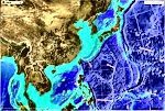
Geospatial and geomatics technologies play a significant role where earthquakes are concerned. GeoNet is a real-time national network that is GNSS-based, and is a collection of individual stations running throughout New Zealand. The PositiNZ network provides continuous monitoring of shifts upon the landscape and at depths of several kilometers. (Image: GeoNet New Zealand)
Spirent, a manufacturer of GNSS technologies, indicated at the time of the Japan earthquake event that GNSS timing was an important factor that contributed toward high accuracy GNSS measurement. This concern, at the time, was important since, “One of the more surprising consequences from the March 2011 earthquake in Japan was that the forces unleashed shifted the earth’s mass sufficiently to accelerate its rotation, shortening each day by no less than 1.8 microseconds, according to calculations by NASA. And while such effects are clearly imperceptible to humans, their cumulative effect on GNSS timekeeping would cause significant inaccuracies that would be unacceptable to any GNSS application.“
Work by the GeoSurf Corporation in Japan, in a paper entitled ‘Developing GNSS Network Monitoring System for Sakurajima Volcano Research‘, described efforts for using GNSS technologies to monitor the runways of the Tokyo International Airport, for shifting positions. “The monitoring system includes 21 observation stations in the runway, and 1 reference station out of runway. One server and two recording computers were used here. The purpose of system is to monitor displacement at the connection part between different structures, so relative position of 2 stations between different structures was estimated here.“
“Today it is common to determine a point’s position using Global Navigation Satellite Systems
(GNSS). Positions are not absolute quantities. They are dependent on the reference frame to
which they are referred. If GPS is used then the point’s position is determined in the reference
system WGS 84. Observing in a good GNSS environment, the absolute accuracy for a single
point position fix is ± 5 – 10 metres in the horizontal – ie 2 dimensions at the 2 sigma (2σ)
confidence level,”says authors Volker Schwieger, Mikael Lilje and Rob Sarib.
It is this realisation that challenges GNSS applications today, since high accuracy alone without continuing research and efforts into reference frames is also important. And just this week we have witnessed the release of Trimble BD910 and BD920 modules, incorporating the latest in GNSS high accuracy capabilities.
Progress is being made. Soon, more networks will be providing up-to-date accuracy and location information to help with understanding and managing impacts of geophysical factors and events.
