Monday, September 11th, 2017
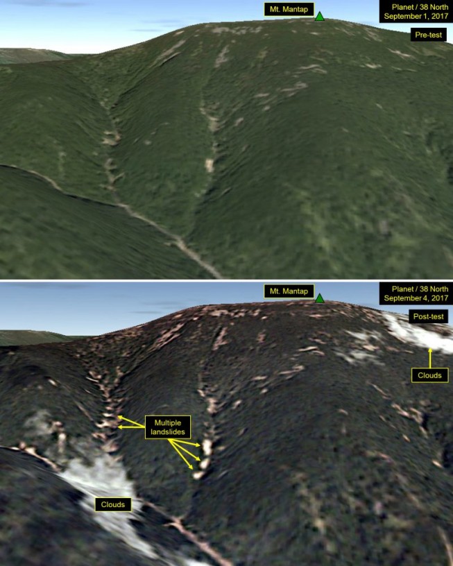
Analysts peering at satellite images of North Korea after its latest nuclear test spotted many landslides and wide disturbances at the country’s test site. Tunnels for the nuclear blasts are deep inside Mount Mantap, a mile-high peak....

Tuesday, September 5th, 2017
An emerging architectural research method is being used to document the architectural heritage of Indonesian buildings wiped out in the 2004 tsunami. Banda Aceh, on the Indonesian island of Sumatra, was one of the worst affected areas...

Tuesday, August 29th, 2017
SpaceX successfully launched FORMOSAT-5, the first fully Taiwan-made Earth observation satellite, from Vandenberg Air Force Base in California on Aug. 24, 2017, nearly four years after its original intended late-2013 launch. The 475-kilogram satellite was sent into...

Tuesday, August 22nd, 2017
The Indian government recently cleared a deal with the United States to purchase 22 MQ-9 Guardian surveillance drones. This deal, initiated last year and officially cleared in June 2017, is worth an estimated $2 billion. The Indian...

Tuesday, August 15th, 2017
South Korea has begun development of Earth-based navigation technology as an alternative to satellite-based systems to protect its ships from cyber attacks. The Earth-based navigation technology is known as eLoran, and is an upgraded version of radio...
Tuesday, August 1st, 2017
Australia officially has its first GPS infrastructure in space, according to the nation’s Minister for Defence Industry Christopher Pyne. A four-kilogram, U.S.-developed Biarri-Point cubesat was launched as part of the QB50 constellation in April 2017 toward the...

Monday, July 17th, 2017
Antrix Corporation Ltd. (ACL), the commercial and marketing arm of the Indian Space Research Organisation (ISRO), is engaged in providing space products and services to international customers worldwide. Antrix solutions range from the supply of hardware and...
Tuesday, June 27th, 2017
Demonstration tests on snow and ice monitoring sensors, led by the Japan Aerospace Exploration Agency (JAXA), have begun at Kitami Institute of Technology (Kitami, Hokkaido). For the tests, researchers have created outdoor, underground installations of the sensors...

Tuesday, June 13th, 2017
The geostationary satellites of EUMETSAT, JMA and NOAA acquired this image of Tropical Cyclone Mora approaching Bangladesh on Monday, May 29, 2017. Cyclone Mora struck the eastern coast of Bangladesh on May 30. The Category 1 hurricane...
Monday, June 5th, 2017
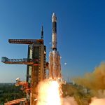
On June 5, 2017, the Indian Space Research Organisation (ISRO) GSLV-Mk III rocket successfully launched from the Satish Dhawan Space Centre, carrying the 3,136-kilogram GSAT-19 satellite to a geosynchronous transfer orbit. With a mission life of 10...
