Asian Surveying & Mapping
Breaking News
Nuri rocket successfully completes KAIST’s next-gen satellite mission
The Korea Advanced Institute of Science and Technology (KAIST)...
President Lai reviews progress on first indigenous satellite constellation
President Lai Ching-te said developing space technology is a...
Japan’s iQPS lines up eight SAR launches
ST. LOUIS — Japan’s Institute for Q-shu Pioneers of...
UAE Astronauts Promote AI and Collaboration in Space at GITEX Europe
The Arab world’s first astronaut, Hazzaa Al Mansouri, and...
New species of space-adapted bacteria discovered on China’s Tiangong space station
Scientists have discovered a previously unknown strain of microbe...
Isro’s 101st mission fails as PSLV-C61 suffers third-stage anomaly
India’s latest Earth observation satellite mission faced a setback...
Iraq’s First Fully Solar-Powered Village in Kulak Is Now Operational
ERBIL, Kurdistan Region – May 20, 2025 — The...
Australia’s Gilmour Space Technologies ready to launch maiden Eris Test flight the nation’s first orbital launch in over 50 years
Gilmour Space Technologies is the leading launch services company...
Korea’s space agency seeks revision of plan to modify next-gen rockets into reusable system
South Korea's aerospace agency said on Thursday that it...
UAE Space Agency Signs Agreement With Technology Innovation Institute to Execute the Emirates Mission to the Asteroid Belt’s Lander Project
In the presence of His Highness Sheikh Hamdan bin...
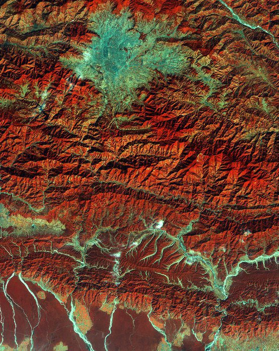
The European Space Agency (ESA) Copernicus Sentinel satellite captured this false-color image of part of Nepal, including its capital city, Kathmandu, and the Himalayan foothills.

Vegetation appears red, while waterways and buildings appear light green and blue.

Although many effects remain of the tragic April 2015 earthquake that killed 9,000 people; destroyed villages, cultural symbols and structures; and forever changed the landscape, recent satellite images, among other evidence, show that the area is moving forward and doing its best to rebuild.

In this image, the runways of the Tribhuvan International Airport are clearly visible near the center of the valley. A “ring road” runs around central Kathmandu city and parts of surrounding cities.

The image demonstrates just a portion of Nepal’s varied terrain: from the mountains to the north to the plains in the south. Water runs off from the mountains, forming large rivers that cut through the forested plain, with some areas of agriculture.
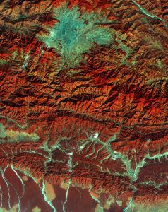
In this Copernicus Sentinel satellite image, the lower part of the image appears hazier than the mountainous areas because humidity is higher in the plains. (Credit: Contains modified Copernicus Sentinel data (2015), processed by ESA)

In this Copernicus Sentinel satellite image, the lower part of the image appears hazier than the mountainous areas because humidity is higher in the plains. (Credit: Contains modified Copernicus Sentinel data (2015), processed by ESA)

Click here for further evidence of Nepal’s regrowth and rebuild.