Top Story
Tuesday, January 16th, 2018
On Jan. 12, 2018, India’s Polar Satellite Launch Vehicle (PSLV-C40), in its 42nd flight, successfully launched from the Satish Dhawan Space Centre the 710-kilogram Cartosat-2 satellite for Earth observation as well as 30 co-passenger satellites. The co-passenger...
Tuesday, December 5th, 2017
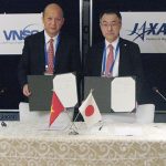
On Nov. 17, 2017, the Vietnam National Space Center (VNSC) and the Japan Aerospace Exploration Agency (JAXA) agreed to cooperate in the field of Public Affairs. JAXA will provide scale models to be exhibited at the Vietnam...
Monday, November 13th, 2017
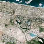
The CNES (Space Agency of France) Pléiades satellite acquired this image of Downtown Dubai, including some of Dubai's most well-known landmarks: the Burj Khalifa, Dubai Mall and Dubai Fountain. Due to the presence of these famous sites,...

Tuesday, October 17th, 2017
An international research team led by Dr. Shin-nosuke Ishikawa, project research fellow of the Japan Aerospace Exploration Agency (JAXA), succeeded in detecting the subtle signs of nanoflares in a region of the solar corona where no discernible...
Tuesday, July 25th, 2017
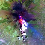
Researchers from the University of Hawaiʻi at Mānoa School of Ocean and Earth Science and Technology (SOEST) recently discovered that infrared satellite data could be used to predict when lava flow-forming eruptions will end. Using NASA satellite...

Monday, July 17th, 2017
Antrix Corporation Ltd. (ACL), the commercial and marketing arm of the Indian Space Research Organisation (ISRO), is engaged in providing space products and services to international customers worldwide. Antrix solutions range from the supply of hardware and...
Tuesday, July 11th, 2017
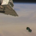
On July 7, 2017, a total of five “BIRDS project” CubeSats were successfully deployed from the Japanese Experiment Module Kibo. The Joint Global Multi-Nation Birds Satellite project is an international joint development and operations project that includes...
Tuesday, June 27th, 2017
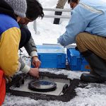
Demonstration tests on snow and ice monitoring sensors, led by the Japan Aerospace Exploration Agency (JAXA), have begun at Kitami Institute of Technology (Kitami, Hokkaido). For the tests, researchers have created outdoor, underground installations of the sensors...
Tuesday, June 20th, 2017
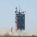
On June 15, 2017, China launched two remote-sensing micro-nano satellites on a Long March-4B rocket from Jiuquan Satellite Launch Center in northwest China's Gobi Desert. The OVS-1A and the OVS-1B, the first two satellites of Zhuhai-I remote-sensing...
Tuesday, May 30th, 2017
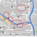
A total of 1.4 million people live in the informal settlements of the West Bengal city of Kolkata, which represents around 30 percent of the urban population. Up until recently, these residents had no addresses accessible via...


