
Asian Surveying & Mapping
Breaking News
HAL to build, market Isro’s SSLV in landmark deal
New Delhi, Jun 20: In a historic move for...
Taiwan developing space capabilities for all-weather imaging
TAIPEI (TVBS News) — Taiwan is advancing its space...
Honda hails successful test of reusable rocket as it looks to get into the space business
Tokyo — Japan's second-biggest carmaker, Honda, has successfully tested...
China’s space program provides larger platform for broader international cooperation
BEIJING -- Experts from China's manned space program said...
India To Launch $1.5 Billion Joint Earth Mission With NASA In July
National Aeronautics and Space Administration (NASA) and the Indian...
Axiom-4 mission delayed again: ISRO confirms Subhanshu Shukla’s ISS spaceflight won’t launch before 22 June 2025
The Axiom-4 mission to the International Space Station has...
Mengzhou spacecraft for China’s moon-landing mission passes landmark test flight
China has completed the inaugural test flight of its...
Space application for ITMA Asia + CITME 2026 opens
Shanghai – Space application for the 2026 edition of...
Yanmar, Chia Tai and XAG Empower Thai Agriculture through Innovation
Bang Nam Priao District, Chachoengsao Province, Thailand – On...
bitsensing Signs MOU with IKIO Technologies to Advance AI-Based Traffic Monitoring on India’s Expressways, Highways and Municipal Areas
Backed by proven success in South Korea and Europe,...

Geo1

image

Monday, July 17th, 2017

Antrix Provides ISRO Space Products for Social Relevance

Antrix Corporation Ltd. (ACL), the commercial and marketing arm of the Indian Space Research Organisation (ISRO), is engaged in providing space products and services to international customers worldwide. Antrix solutions range from the supply of hardware and...

Tuesday, July 11th, 2017

Five ‘BIRDS Project’ CubeSats Successfully Deployed from Kibo

On July 7, 2017, a total of five “BIRDS project” CubeSats were successfully deployed from the Japanese Experiment Module Kibo. The Joint Global Multi-Nation Birds Satellite project is an international joint development and operations project that includes...

Tuesday, June 27th, 2017

JAXA Tests Snow and Ice Sensors

Demonstration tests on snow and ice monitoring sensors, led by the Japan Aerospace Exploration Agency (JAXA), have begun at Kitami Institute of Technology (Kitami, Hokkaido). For the tests, researchers have created outdoor, underground installations of the sensors...

Tuesday, June 20th, 2017

China Launches Remote-Sensing Micro-Nano Satellites

On June 15, 2017, China launched two remote-sensing micro-nano satellites on a Long March-4B rocket from Jiuquan Satellite Launch Center in northwest China's Gobi Desert. The OVS-1A and the OVS-1B, the first two satellites of Zhuhai-I remote-sensing...

Tuesday, June 13th, 2017

Satellites See Tropical Cyclone Mora Approaching Bangladesh

The geostationary satellites of EUMETSAT, JMA and NOAA acquired this image of Tropical Cyclone Mora approaching Bangladesh on Monday, May 29, 2017. Cyclone Mora struck the eastern coast of Bangladesh on May 30. The Category 1 hurricane...

Monday, June 5th, 2017

ISRO Successfully Launches GSAT-19

On June 5, 2017, the Indian Space Research Organisation (ISRO) GSLV-Mk III rocket successfully launched from the Satish Dhawan Space Centre, carrying the 3,136-kilogram GSAT-19 satellite to a geosynchronous transfer orbit. With a mission life of 10...

Tuesday, May 30th, 2017

Kolkata’s Slum Lanes Digitized for GPS

A total of 1.4 million people live in the informal settlements of the West Bengal city of Kolkata, which represents around 30 percent of the urban population. Up until recently, these residents had no addresses accessible via...
Wednesday, May 24th, 2017

China’s Satnav Industry Grows 22 Percent in 2016

The output value of China's satellite navigation and location-based service industry reached 211.8 billion yuan ($30.8 billion U.S.) in 2016, up 22.1 percent year on the year, according to an industry white paper released by the Global...

Wednesday, May 17th, 2017

Scientists Use Satellites to Count Endangered Birds in New Zealand

Scientists in New Zealand are using high-resolution images from DigitalGlobe’s  WorldView-3 satellite to gauge the numbers of Northern Royal albatrosses, an endangered animal that nests almost exclusively on some rocky sea-stacks close to New Zealand’s Chatham Islands....
Tuesday, May 9th, 2017

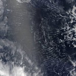
MODIS Satellite Captures Roll Clouds Over Pacific Atolls

Areas near the equator are frequently cloudy, obscuring the view of Earth’s surface from space. April 7, 2017, was no different. On that day, the Moderate Resolution Imaging Spectroradiometer (MODIS) on NASA’s Terra satellite captured this natural-color...

Page 2 of 5 1 2 3 4 5