Asian Surveying & Mapping
Breaking News
Safran, SatSure partner to develop geospatial intelligence solutions for India
French aerospace giant Safran Electronics & Defense and Indian...
Singapore unveils road map to help develop international business standards and conformance
Singapore has unveiled plans to help develop international standards...
Adelaide University to run space and defence venture launchpad ahead of Australian Space Forum
Adelaide University’s Innovation & Collaboration Centre (ICC) will deliver...
Japan’s H3 rocket returns to space with successful launch after December setback
Japan’s flagship H3 rocket has returned to flight six...
KONGSBERG accelerates seabed mapping developments with Ocean Exploration Trust expedition aboard Exploration Vessel Nautilus
KONGSBERG and the Ocean Exploration Trust (OET) are set...
Russian satellites linked to mysterious GPS disruptions across several countries
Since 2019, GPS signals across Europe, Greenland and Canada...
Isro’s Bahubali LVM3 that launched Chandrayaan-3 to be handed to private sector
IN-SPACe has invited Indian companies to take over the...
India to host 13th UN Global Geospatial Information Management Asia-Pacific Conference
India is hosting the 13th United Nations Global Geospatial...
Unseenlabs’ BRO-22 to Become the First Foreign Private Satellite Launched Aboard Japan’s H3 Launch Vehicle
Scheduled for June 10, between 09:53 and 11:52 a.m....
PLD Space increases investment in its Launch Complex at the Guiana Space Centre (CSG) to €35M, strengthening Europe’s sovereign space infrastructure
The investment is expected to generate approximately €21 million...

June 22nd, 2011
GeoMobile Map Hong Kong Launches

GeoMobileHongKong

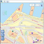
“GeoMobile Map takes advantage of multi-touch technology, allowing users to smoothly zoom in and out of a map on their mobile devices,” a spokesman for the Lands Department said. “It also incorporates a strengthened geographic search engine, supporting not only the search for places, streets and buildings in Hong Kong, but also simple semantic searches, such as ‘museums in Central’, ‘supermarkets within map area’.

GeoMobile Map uses the GPS on the device to show the position of a user and to identify points of interest, such as tourist attractions, public transportation, cultural facilities, gas stations, car parks, charging points for electric vehicles, hospitals, clinics, police stations, post offices, shopping malls, registered pharmacies, convenient stores and supermarkets.

Users can also share a marked map with their friends for for them to view on their own devices.

GeoMobile Map supports mobile devices and smartphones running on iOS and Android operating systems. The new service can be accessed via www.map.gov.hk/mobile.