Thursday, December 18th, 2014
Tel Aviv, Israel, Dec. 18, 2014—Eternix Ltd., leading provider of next-generation geospatial software, announced today the release of Blaze Terra 4.0, the company’s flagship product. The new version includes advanced geospatial browsing and search tools and a full...
Thursday, December 18th, 2014
STEVENAGE, UK, Dec. 18, 2014—Cadcorp, the UK based developer and supplier of GIS and web mapping software, has unveiled Web Map Layers 8.0. The web mapping application, which is widely-used for sharing geographic information with the public, has...
Monday, March 17th, 2014
The public-private partnership in geospatial information sharing is essential in avoiding duplication of efforts in data acquisition. The collaboration helps save millions of ringgit from the government's coffers, said Natural Resources and Environment Minister Datuk Seri G....
Tuesday, July 30th, 2013
Esri released the new version of ArcGIS today, marking a major milestone in the history of the Esri platform. With ArcGIS 10.2, Esri has taken advantage of the significant changes in IT that magnify the power and...
Wednesday, May 8th, 2013
The Leica GR25 GNSS Reference Server has now been enhanced with a standard on-board WLAN module to extend its Ethernet and mobile wireless internet connectivity options. This is accompanied by the new RefWorx on-board firmware v3.00, adding...
Thursday, March 21st, 2013
Australia’s national security strategy must have a strong Geographic Information System (GIS) technology component to ensure the country can keep pace with new challenges and safely host major events such as the G20 and Commonwealth Games, a...
Monday, January 14th, 2013
The Geographic Information System (GIS) is a technology that defines a framework to gather and organise those data by linking them with the location. Not only does GIS visualise the information using maps, it can analyse the...
Thursday, August 4th, 2011
Orbit GeoSpatial Technologies is proud to announce the launch of Orbit GIS X, the new generation desktop GIS. Orbit GT today announces the availability of Orbit GIS X. Totally reworked, Orbit GIS X is the new engine for...
Wednesday, June 22nd, 2011
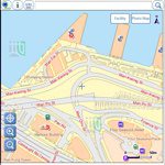
The Lands Department of Hong Kong launched a new mobile mapping application called "GeoMobile Map Hong Kong" this week, allowing users to view detailed government maps and to search for community facilities while on the move. This...