Asian Surveying & Mapping
Breaking News
Australia’s Gilmour Space Technologies ready to launch maiden Eris Test flight the nation’s first orbital launch in over 50 years
Gilmour Space Technologies is the leading launch services company...
Korea’s space agency seeks revision of plan to modify next-gen rockets into reusable system
South Korea's aerospace agency said on Thursday that it...
UAE Space Agency Signs Agreement With Technology Innovation Institute to Execute the Emirates Mission to the Asteroid Belt’s Lander Project
In the presence of His Highness Sheikh Hamdan bin...
Private Japanese lunar lander enters orbit around moon ahead of a June touchdown
A private lunar lander from Japan is now circling the moon, with...
Indian astronaut to travel soon to ISS as part of ISRO-NASA Mission
Prime Minister Narendra Modi said by 2040, an Indian’s...
China issues regulatory framework to support direct-to-device satellite services
HELSINKI — China has released comprehensive regulations for direct-to-device...
Astranis clinches $115 million Taiwan deal despite satellite setback
TAMPA, Fla. — Astranis has signed a $115 million...
UAE and Egypt Strengthen Space Collaboration with New MoU
In a milestone development for Arab space collaboration, the...
Seoul launches 4th spy satellite to boost North Korea surveillance
South Korea’s military now operates an increasingly integrated cluster...
Indonesia seeks space defense cooperation with Japan’s military
Jakarta (ANTARA) - The Ministry of Defense of Indonesia...

mobile mapping

Friday, June 23rd, 2017

Mobile Mapping System in Reconstruction and Expansion of Highway in India

India is at an infrastructure crossroads. As demand for infrastructure development has grown, the country’s tireless growth has raced ahead of its ability to develop and deliver the necessary number infrastructure projects. Read More at Hi Target

Tuesday, September 27th, 2016

Geodetics Introduces Mobile Mapping System with Lidar, GPS

Geodetics Inc.’s newest mobile mapping product, Geo-MMS, is a fully integrated lidar mapping payload for integration with unmanned aerial systems (UAS). The Geo-MMS includes an inertial navigation system (INS) coupled with a lidar sensor. Raw data from the...

Thursday, September 15th, 2016

Orbit GT and AAM Group, Australia, Join Forces to Open New Horizons in the Mobile Mapping Market

Orbit GeoSpatial Technologies is proud to announce that AAM Group, Australia, has been selected as Integration and Service Partner of Orbit GT Mobile Mapping and Oblique software products.   AAM Group’s Executive Director Brian Nicholls and Orbit...

Tuesday, September 15th, 2015

Applanix Introduces Two New Direct GeoReferencing Solutions for High Productivity Land- Based Mobile Mapping, Autonomy & Field Robotics Applications

Stuttgart, Germany, September 15, 2015 — Applanix Corporation, a world leader in products and solutions for mobile mapping and positioning, introduced today two new solutions to its POS LV™ (Position and Orientation Solution for Land Vehicles) portfolio, the POS LV...

Tuesday, September 15th, 2015

Applanix Introduces New Entry-Level Solution for Airborne Mapping Applications

Stuttgart, Germany,September 15, 2015 — Applanix Corporation, a world leader in products and solutions for mobile mapping and positioning, announced today the POS AVX™ 210, the latest addition to its airborne position and orientation portfolio for direct...

Thursday, April 23rd, 2015

Remote GeoSystems Releases & Ships 2nd Generation geoDVR


FORT COLLINS, Colorado, USA, April 23, 2015 — Remote GeoSystems, Inc. is pleased to announce the official release and shipment of the geoDVR™ Gen2 – Remote Geo’s second generation Geospatial Digital Video Recorder.

Thursday, March 15th, 2012

Applanix Introduces POSPac MMS V6 for Improved Mobile Mapping Performance

Applanix, introduced today POSPac MMS V6, its latest version of office software for mobile mapping. Featuring full support for GPS and GLONASS satellite observables with its industry-leading IN-FusionTM technology and SmartBaseTM Virtual Reference Station processing engines, POSPac...

Tuesday, October 4th, 2011

Terrasolid Training Event in Jakarta, Indonesia

Terrasolid is organizing a training event for users in South Asia and Australia. The training takes place the week before Asia Geospatial Forum. Terrasolid is also attending the the exhibition. There are many new features like mobile mapping...
Wednesday, June 22nd, 2011

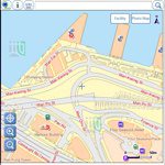
GeoMobile Map Hong Kong Launches

The Lands Department of Hong Kong launched a new mobile mapping application called "GeoMobile Map Hong Kong" this week, allowing users to view detailed government maps and to search for community facilities while on the move. This...