
Thursday, November 18th, 2010
China has slowly re-opened the door for development of mega hydro projects. This follows a period where such development was limited due to environmental concerns. A number of projects have recently been given approval to proceed including...

Thursday, November 4th, 2010
The Group on Earth Observations (GEO) convenes in China this week to discuss the creation and coordination of the planetary system of earth observation. The Seventh Plenary Session from Nov. 3-5 in Beijing marks the fifth year...

Thursday, November 4th, 2010
The Defence Research and Development Organization (DRDO), one of Asia's largest research and development organizations, has teamed with Elcome Technologies in India to deploy the Snow and Avalanche Study Establishment (SASE). SASE is deploying the SiteMonitor laser...

Saturday, October 30th, 2010
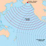
During the past week we have learned that the existing Tsunami Warning Systems in Indonesia have been vandalised. This act may have contributed toward the greater number of deaths as, any...

Friday, October 29th, 2010
The idea of Virtual Australia is to build a fully interoperable interactive 3D photo-realistic simulation of the natural and built environment on all scales down to 2cm, including internal spaces and...

Thursday, October 28th, 2010
Dr. Kasturirangan, the chairman of the Indian Space Research Organization (ISRO), spoke this week at the inaugural National Seminar on Management of Natural Resources and Environment. He emphasized the important role of space technologies for natural resource...

Friday, October 22nd, 2010
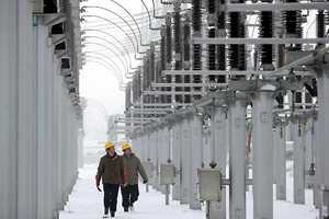
Central Southern China Power Institute presented at the recent Be Inspired 2010 Conference this week in Amsterdam. The institute employs 1400 people and 80 engineers. It has completely advanced the construction processes for many substations, moving from...

Friday, October 15th, 2010
Traditionally the spatial information sector has been very good at collecting geodata and processing it. The number and types of different sensors has grown from digitization to aerial imagery and now includes integrated sensors that are able...