Asian Surveying & Mapping
Breaking News
Australia’s Gilmour Space Technologies ready to launch maiden Eris Test flight the nation’s first orbital launch in over 50 years
Gilmour Space Technologies is the leading launch services company...
Korea’s space agency seeks revision of plan to modify next-gen rockets into reusable system
South Korea's aerospace agency said on Thursday that it...
UAE Space Agency Signs Agreement With Technology Innovation Institute to Execute the Emirates Mission to the Asteroid Belt’s Lander Project
In the presence of His Highness Sheikh Hamdan bin...
Private Japanese lunar lander enters orbit around moon ahead of a June touchdown
A private lunar lander from Japan is now circling the moon, with...
Indian astronaut to travel soon to ISS as part of ISRO-NASA Mission
Prime Minister Narendra Modi said by 2040, an Indian’s...
China issues regulatory framework to support direct-to-device satellite services
HELSINKI — China has released comprehensive regulations for direct-to-device...
Astranis clinches $115 million Taiwan deal despite satellite setback
TAMPA, Fla. — Astranis has signed a $115 million...
UAE and Egypt Strengthen Space Collaboration with New MoU
In a milestone development for Arab space collaboration, the...
Seoul launches 4th spy satellite to boost North Korea surveillance
South Korea’s military now operates an increasingly integrated cluster...
Indonesia seeks space defense cooperation with Japan’s military
Jakarta (ANTARA) - The Ministry of Defense of Indonesia...
substation_thumb

The development of mega hydro projects has been proposed for some time. Recently the ‘Go West’ development plan was revisited. It includes “a plan to invest more than USD $100 billion 23 infrastructure projects “to promote the fast and healthy development of the western areas,” said Asian Times. There are others.

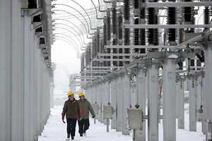
The need for power is so great, that it has been noted that the construction of nuclear generating facilities cannot keep up in terms of construction. However, geospatial technologies are being used for developing design plans of mega hydro facilities. These CAD based designs often include 3D approaches, thereby expediting the process and improving design efficiency.

In fact, geospatial tools are involved from initial surveying of these locations which depend upon total stations and other GNSS measurement technologies to the construction of roads and excavation work. As we begin to see dozens of projects come to fruition we can look forward to higher demand for surveying relate technology and planning-design collaborative software.