Tuesday, January 26th, 2021
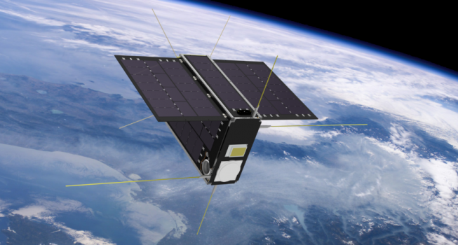
Led by the SmartSat Cooperative Research Centre (CRC), the AUD$6.5 million SASAT1 Space Services Mission was announced in Adelaide, South Australia. Based at Lot Fourteen, which is also home to the Australian Space Agency, the SmartSat Cooperative...

Tuesday, January 12th, 2021
In an online event organised on Jan. 11, 2021, Department of Space and Atal Innovation Mission, NITI Aayog announced that ISRO will be adopting 100 Atal Tinkering Labs (ATLs) across the country, out of which 45 ATLs...
Monday, December 7th, 2020
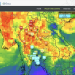
For decades, NASA has used the vantage point of space, combined with airborne and ground-based field campaigns, to decipher the impact of air pollution and help other agencies protect people when unhealthy air threatens the places they...
Monday, November 23rd, 2020
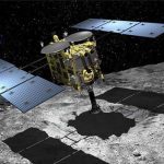
Japan Aerospace Exploration Agency’s (JAXA) Hayabusa2 sample-return capsule, which may lead to answers to the origin of life on Earth, will land in Woomera, South Australia, on Dec. 6, 2020. The capsule contains samples collected from primordial...
Tuesday, November 10th, 2020
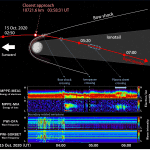
The Japan Aerospace Exploration Agency (JAXA) and European Space Agency (ESA) measured the trajectory of the Mercury Magnetospheric Orbiter, known as “Mio,” and the Mercury Planetary Orbiter (MPO) following the Venus flyby on Oct. 15, 2020. The...

Tuesday, October 27th, 2020
Designed and developed in Adelaide, South Australia, Silentium’s MAVERICK S-series is the first commercial-scale passive radar system for surveillance of space and will provide persistent detection and tracking of objects in low-earth orbit to support space traffic...
Monday, October 12th, 2020
William Dampier was not a typical pirate. Between pillages, the curious English sailor took detailed notes about local wildlife and even collected plants—some of which are still preserved today—on his voyages around the world. His travel logs...
Monday, September 28th, 2020
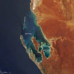
The Republic of Kiribati is an independent island nation consisting of some 33 atolls near the equator in the central Pacific. The islands are spread over approximately 3.5 million square kilometers of ocean, but with a total...
Tuesday, September 15th, 2020
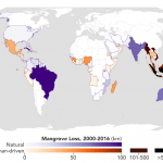
Using high-resolution data from the joint NASA-U.S. Geological Survey Landsat program, researchers have created the first map of the causes of change in global mangrove habitats between 2000 and 2016—a valuable tool to aid conservation efforts for...

Monday, August 31st, 2020
The Oryctes drone, which applies spray fluid with centimeter-level precision at the center of oil palms, was designed and developed by a Malaysian team over a 12-month period and is the latest development in agrotechnology that capitalizes...
