Asian Surveying & Mapping
Breaking News
Australian Space Agency funds development of aerospace-grade GNSS receiver
The Australian Space Agency has funded the development of...
Continuity risks for Australian EO data access
A new report details the widespread use of Earth...
China launches new remote sensing satellite
JIUQUAN, April 15 (Xinhua) -- China on Monday launched...
7.4-Magnitude Earthquake Strikes Taiwan
A major, 7.4-magnitude earthquake struck the eastern coast of...
Tata Deploys Its Geospatial Satellite In Space on Space X’s Falcon 9 Rocket
THIRUVANANTHAPURAM: Tata Company launched India's first private commercial satellite...
Taiwan’s Formosat-8 Satellite Set for Launch by 2025
The Taiwan Space Agency has announced progress on the...
Iranian Scientists to Build Satellite Constellation for 2 Simultaneous Missions
The scientists at the knowledge-based company had previously succeeded...
China provides geospatial intel and other military support to Russia, US says
The US has warned its European allies that China...
Japanese lunar lander company ispace raises $53.5 million in stock sale
WASHINGTON — Japanese lunar lander developer has raised $53.5...
Esri and Prince Sultan University Advance GIS Education Through Strategic Partnership
Memorandum of Understanding with Institution Enhances GIS Curriculum and...

spatial data

Tuesday, June 21st, 2011

GeoDesign – New Era for Community Consultation

The merging of design and Geographic Information Systems (GIS) technology would revolutionise urban planning and truly open up community development to the public, Esri Australia Western Australian Business Manager Tom Gardner told the Western Australian Surveying and...

Monday, June 13th, 2011

CSIRO Dam Break Modelling to Help Flood Planning

The research has been helping China’s disaster management authorities better understand the full impact of the catastrophic flooding that would occur if one of China’s, and the world’s, biggest dams collapsed. The work could also be applied in...

Thursday, June 9th, 2011

SuperGIS Mobile Engine Application Selected by Regione Marche in Italy

SuperGeo Technologies announced that its exclusive partner in Italy, Helix S.r.l., has successfully promoted the Helix Mobile Mapping System (HMMs) to Regione Marche for civil protection and spatial data collection. Regione Marche is a regional government sector...

Wednesday, June 8th, 2011

Fujifilm Selects NAVTEQ Maps New GPS Enabled Digital Cameras

NAVTEQ has been selected by Fujifilm to support the introduction of their new GPS-enabled digital cameras with map data and POI content. NAVTEQ is now supplying map and POI (points of interest) data for Fujifilm's FinePix F550EXR...

Tuesday, June 7th, 2011

Property Ownership Data on GIS Platform

Tracking ownership details of properties in Lutyens' Delhi to get your leasehold property converted to freehold — so that you can become the rightful owner — is likely to become a hassle-free task. All records, data, ownership...

Friday, June 3rd, 2011

Map Serving for Surveyors

Map Servers are providing useful geospatial geomatics data worldwide. These servers have several advantages due to the fact that they combine all kinds of spatial data - including surveying data. Today surveyors are using a wide range...

Tuesday, May 31st, 2011

SuperGIS Server 3 Supports KML Services

SuperGeo Technologies announced that SuperGIS Server 3 supports KML (Keyhole Markup Language) map service publishing and assists enterprises in improving map sharing and display performance.  

Thursday, April 28th, 2011

Thailand to Launch NSDI Portal by 2012

The Thai government has laid down plans to launch the country’s National Spatial Data Infrastructure (NSDI) portal by 2012 which will serve as the national gateway for spatial information and pave the way towards “Spatially Enabling” Thailand. Dr....
Thursday, April 28th, 2011

National Spatial Data Infrastructure Take Root in Asia

National Spatial Data Infrastructures (NSDI) continue to expand and grow across Asia. Thailand this week has indicated that the country is aiming to initiate it's own NSDI by 2012. As with other similar projects, the goal for...
Tuesday, April 19th, 2011

Spatial Data – Key to Landscape Modeling

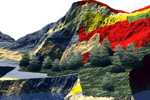
The ability to analyze, model and simulate natural disaster events and their consequences is unique to the geospatial and geomatics sector. No other tools provide data management, analysis and the associated visual output, useful for decision-making purposes...

Page 7 of 10 1 2 3 4 5 6 7 8 9 10