
Tuesday, April 12th, 2011
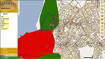
SuperGeo Technologies announced its latest GIS application to spatial data management in one of the most reputed National Parks in Taiwan. Covering Kinmen Island and many other islets, Kinmen National Park is characterized by its historical battle...
Wednesday, April 6th, 2011
The Municipality of Abu Dhabi City has launched the initial phase of "Makani" service to serve as a Geographical Information Systems (GIS) Portal and a focal point of information and spatial data-related assets. The Portal is set to...
Tuesday, March 22nd, 2011
An earthquake measuring 8.9 on the Richter scale followed by 10-meter high tsunami in Japan, last week managed to remove the perception of the international community since the beginning of this year's protest focused on the disaster...
Monday, March 21st, 2011
National Economic and Development Authority (NEDA) Caraga will launch its Regional Geographic Information System Center (RGISC) on March 22. The RGISC promotes Geographic Information System (GIS) as a tool for effective planning, decision-making, policy formulation, investment programming and...
Sunday, March 20th, 2011
The Central Environmental Authority (CEA) has develop an environmental resource information data base for each district as environmental profile by using its expertise knowledge on remote sensing and spatial data bases. The data base will allow identifying spatial...
Sunday, March 13th, 2011
The 2011 Scientific Program of IUGG includes three categories of symposia and a number of workshops on a wide range of geophysical themes. These include:

Tuesday, March 8th, 2011
Officially released in February 2011, SuperNetObjects 3 contains a wide range of network analysis functions for developers to undertake powerful applications. The operation and the objects this brand-new SuperNetObjects 3 provides greatly surpass its previous version, SuperNetObjects...
Saturday, February 26th, 2011
The current review of the Standard commenced in August 2010 to better align the QSIC foundation spatial to other foundation spatial data listings, in particular, with the DERM fundamental data. It was recognised the 2009 QSIC foundation data mixed...
Wednesday, February 23rd, 2011
Safe Software, the global leader in spatial data transformation, announced today the kick-off of the FME 2011 World Tour, a customer event series that will be held in 25+ cities worldwide starting this March. Co-hosted with Safe...