Asian Surveying & Mapping
Breaking News
South Korea is converting an abandoned coal mine into a moon exploration testing ground
South Korea is transforming abandoned coal mines into testing...
ISRO to Launch Chandrayaan-5 With Japan, Plans Space Station
Dr. V. Narayanan, Chairman of the Indian Space Research...
Russia and China are threatening SpaceX’s Starlink satellite constellation, new report finds
SpaceX's Starlink satellite constellation is facing threats from Russia...
China and Pakistan agree to fly 1st foreign astronaut to Chinese space station
For the first time, the Chinese space program will train...
ISRO’s “Space on Wheels” offers a peek into Indian Space Programme to students in Karimnagar
The Indian Space Research Organisation (ISRO)’s “Space on Wheels”...
Geospatial led solutions build the foundations for better decision-making
Geo Connect Asia 2025 paves the way for turning...
GEOSA, Singapore Land Authority Launch Achievements of Joint Geospatial System Project
Riyadh, SPA -- The General Authority for Survey and...
Building in Bangkok collapses as powerful earthquake hits southeast Asia
One person has died and 50 were injured in...
Bellatrix Aerospace Partners with Astroscale Japan for Space Debris Removal
Bellatrix Aerospace, a Bengaluru-based space mobility company, has joined...
NSTC announces Pingtung site as Taiwan’s space mission launch center
Taipei, March 26 (CNA) Taiwan's National Science and Technology...
kml

SuperGIS Server 3, a set of map server software designed for GIS resource processing, provides users with multiple GIS server capabilities in developing, managing, integrating, and publishing GIS services in the centralized server framework.  

A wide range of spatial data and images can be released on the Internet as GIS services. With SuperGIS Desktop, SuperPad and Web browsers, front-end users can directly access the map services published by SuperGIS Server 3.   

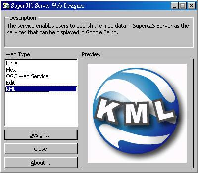
Besides its original functions, SuperGIS Server 3 now supports map services which conform to KML format for advancing map resource sharing. Users can add this service that is saved as a website address to the software platforms which can read KML format, such as Google Earth, to overlay, display and navigate map.  

What is more, users are able to edit maps online with the edit service published by SuperGIS Server 3, which supports Web Map Service (WMS), Web Coverage Service (WCS) and Web Feature Service (WFS) defined by Open Geospatial Consortium (OGC) standards.  

Employing SuperGIS Server 3 as the main map server software, enterprises can not only improve the management and usability of map data, but also elevate their competitiveness with best workflow.  

For the latest free trial of SuperGIS Server 3 and further information of SuperGeo, please visit www.supergeotek.com