Asian Surveying & Mapping
Breaking News
China unveils first homegrown space mining robot
China's first space mining robot has been developed by...
North Korea rejects G7 call for denuclearization, vows to ‘strengthen’ nuclear forces
North Korea on Monday vowed to "steadily update and...
Taiwan showcases innovative technologies at Satellite 2025
Innovative technologies are on display at the Taiwan Space...
Japanese Astronaut Onishi departs with three others for 2nd Space Mission
Takuya Onishi has left for space for his second...
Saudi Arabia, Korea Sign Memorandum of Cooperation to Enhance Space Collaboration
Riyadh, SPA: The Saudi Space Agency (SSA) today signed...
UAE, Bahrain boost space and climate monitoring with satellite launches
The UAE and Bahrain successfully launched on Sunday their satellites, Etihad-SAT and...
UAE launches first SAR satellite Etihad-SAT
The satellite, weighing 220kg, was launched into space aboard...
China opens 2028 Mars sample return mission to international cooperation
HELSINKI — China is inviting interested parties to submit...
ISRO Chairman Inaugurates Research Centre At IIT Madras To Address Thermal Challenges In Space Applications
This will be nodal centre for research in heat...
Chandrayaan-5 Mission Approved, To Carry 250 kg Rover: ISRO Chief
The Chandrayaan programme has been instrumental in India's lunar...
map_server

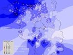
Many company’s are developing map serving capabilities including SuperGeo Technologies, Esri, MapServer, QGIS, Autodesk, Bentley and others.

These servers often connect directly to surveying technologies and notebooks / tablets used in the field for surveying. 

This connections enables direct links that exchange data back and forth from field to office in real-time. Additionally, surveyor- map server connections support greater collaboration with other users of the same data. 

Architects, city planners, environmental, emergency management, disaster services and utilities together with other agencies all rely upon the same survey data. Stimulating use and integration of this information is increased when map servers are used – they don’t just serve maps – but serve data. 

In the future we are likely to see map server use grow for these reasons. As new 3rd party solutions are developed, these too will be integrated into these servers, expanding their value and increasing the broader use of spatial data.