Tuesday, November 22nd, 2011
The management of access rights to services and data is increasingly becoming a key requirement, both in service-based spatial data infrastructures as well as company-wide enterprise solutions. con terra GmbH has developed sdi.suite securityManager specifically for these...
Sunday, November 20th, 2011
Major environment-focused Crown Research Institutes GNS Science, Landcare Research, and NIWA are joining forces with the New Zealand Geospatial Office to harmonise systems for storing, categorising and accessing vital information on New Zealand's environment. The move will...

Wednesday, November 16th, 2011
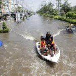
The number and severity of flood events throughout Asia has increased in recent times. Cambodia, Laos, Thailand, Burma and Vietnam have all experienced major flood disasters recently. Integrated flood management is emerging as a comprehensive approach for...
Monday, November 14th, 2011
Remote sensing technology would be used to prepare a resource atlas of the state. The technology was being used to collect data and images from satellites. It would be used in the next five-year plan as well,...
Thursday, October 27th, 2011
SuperGeo announced that the branch company of Aurecon Company in South Africa has purchased SuperGIS Desktop 3 for their GIS/Data Management Department, which is planning to cooperate with SuperGeo’s South Africa distributor, Spatial Perspective for the purpose...
Wednesday, October 19th, 2011
SuperGeo Technologies is pleased to announce the latest sales achievement in Japan, where SuperGIS Desktop 3 has been selected by National Institute of Infectious Diseases to improve the research outcome and...
Wednesday, October 19th, 2011
The complete map server functions in SuperGIS Server 3 can efficiently create, manage, integrate, and publish multiple GIS services, which assist enterprises in centrally managing...

Thursday, October 13th, 2011
SuperGeo Technologies is authorized to develop a WebGIS to integrate the spatial information related to nuclear disaster. The system provides rich real-time information for the officials to check on maps via the Internet. The precision and reliability of decision-making can...
Thursday, October 13th, 2011
Hannover Fairs Australia and the Office of Spatial Policy will stage the third spatial@gov® Conference and Exhibition in Canberra from 15 to 17 November 2011. The Conference will explore the increasingly important influence that Geospatial information...