In a recent article from the Bangkok Post entitled ‘Simulation Systems Could Help‘ it was noted that the development of suitable simulation analysis could help to understand, assess and to provide improved decision-making performance when natural disasters happen.
“Systems using satellite imagery, remote sensing, climate databases and high computing power can predict risk coverage areas by simulating water flows and rain density, with geo-informatics applied to estimate how many households could face damage. These systems could help reduce or eliminate false or excessive damage claims and also help authorities evaluate damage more efficiently,” the Bangkok Post states.
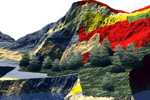
Examples of this can be seen where Tsunami Flood Inundation Mapswere developed for the Japanese impacted areas due to the recent tsunami event there. Scientists at Caltech have discovered that the use of GPS is “helping them find their way to a more complete understanding of Earth’s interior structure.” Such understanding goes a long way to understanding how the inner earth may respond.
Other work seeks to link climate change adaptation to the subsequent related economic risks that emerge. “Disaster risk management addresses several global changes at the same time: First, it reduces the harm caused by natural disasters, and increase the ability of societies to respond, recover and develop. Second, it is vital for designing preventive measures to adapt to a changing climate. However, an effective risk management necessitates accurate knowledge including key uncertainties of what is at stake. The knowledge about impacts of past disasters as well as current and future disaster risk is all but incomplete. At best, only direct losses are known and this only for some of the key sectors. Little attention is paid to indirect (knock-on) and intangible effects, albeit these together may exceed the direct losses.” Many of these topics will be discussed during MODSIM 2011 in Peth, Australia later this year in Australia.
It appears one thing is certain, we do not understand these impacts well, yet. They arise unexpectedly, and their tolls continue to arise and cause significant damage and great human impacts. Even small gains in understanding these impacts and preparing for them through the use and application of tools back with accurate and quality spatial data could have major positive outcomes.
