Tuesday, June 4th, 2019
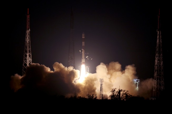
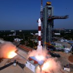
On May 22, 2019, India’s PSLV-C46 successfully launched the RISAT-2B satellite from the Satish Dhawan Space Centre (SDSC) SHAR in Sriharikota. PSLV-C46 was the 72nd launch vehicle mission from SDSC SHAR, Sriharikota. In this mission, the “Core-Alone”...
Tuesday, May 28th, 2019
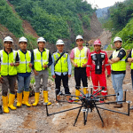
Terra Drone Indonesia successfully completed two pilot projects that demonstrate how construction companies can benefit from drone surveying and mapping services. Using drones equipped with Light Detection and Ranging (LiDAR) technology, Terra Drone Indonesia carried out survey-grade...
Monday, May 20th, 2019
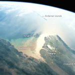
Using a short lens to give a wide view, an astronaut aboard the International Space Station (ISS) focused a camera on the 160-kilometer-wide Irrawaddy river delta. The Irrawaddy is the largest river in Burma (Myanmar) and the...
Tuesday, May 14th, 2019
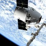
On May 9, 2019, NASA's OCO-3 satellite was removed from the SpaceX Dragon spacecraft and robotically installed on the exterior of the International Space Station's Japanese Experiment Module-Exposed Facility (Kibo), the space station’s largest module. Since then,...
Thursday, May 2nd, 2019
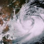
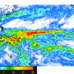
This Copernicus Sentinel-3 image captured on May 1, 2019, shows Cyclone Fani. Brewed in the Bay of Bengal and heading westwards, the cyclone was expected to make landfall on India’s east coast on May 3. With wind...
Tuesday, April 30th, 2019
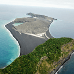
On Oct. 8, 2018, Dan Slayback of NASA’s Goddard Space Flight Center in Greenbelt, Md., joined scientists and students with the Sea Education Association’s SEA Semester South Pacific cruise to visit a three-year-old island he’d only seen...
Wednesday, April 24th, 2019
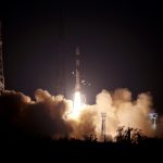
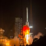
China successfully launched a new navigation satellite, Beidou-44, on April 20, 2019. The launch took place from the LC3 Launch Complex of the Xichang Satellite Launch Center, Sichuan province, using a Long March-3B/G2 launch vehicle. The satellite...
Tuesday, April 16th, 2019
An El Niño that began to form last fall has matured and is now fully entrenched across the Pacific Ocean. Changes in sea surface temperatures (SSTs) brought about by an El Niño affect the atmosphere, resulting in...
Tuesday, April 9th, 2019
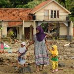
A major new survey of Indonesia’s eastern seafloor has been approved by the Royal Society in a move hoped to boost the country’s resilience to deadly tsunamis. Twice in late 2018 Indonesia suffered horrendous casualties when large...
Tuesday, April 2nd, 2019
On April 1, 2019, India’s Polar Satellite Launch Vehicle (PSLV-C45) successfully launched EMISAT and 28 international customer satellites from Satish Dhawan Space Centre (SDSC) SHAR in Sriharikota. This flight marked the first mission of PSLV-QL, a new...
