Asian Surveying & Mapping
Breaking News
Japan Eyes Sovereign D2D Satellite Network
Japan plans to select a proposal this month for...
China schedules Long March 10B rocket launch and recovery attempt
HELSINKI — China is set for a debut flight...
BRICS space agencies meet begins in Bengaluru
Heads and senior representatives of the space agencies of...
“India’s growing space ecosystem to drive global collaboration”, says ISRO Chairman V Narayanan after BRICS Space Agencies Meeting
"India's growing space ecosystem to drive global collaboration", says...
UAE aims to see Emirati on Moon in next 10 years, says MBRSC chief
UAE expects to have a presence on the Moon within...
Safran, SatSure partner to develop geospatial intelligence solutions for India
French aerospace giant Safran Electronics & Defense and Indian...
Singapore unveils road map to help develop international business standards and conformance
Singapore has unveiled plans to help develop international standards...
Adelaide University to run space and defence venture launchpad ahead of Australian Space Forum
Adelaide University’s Innovation & Collaboration Centre (ICC) will deliver...
Japan’s H3 rocket returns to space with successful launch after December setback
Japan’s flagship H3 rocket has returned to flight six...
KONGSBERG accelerates seabed mapping developments with Ocean Exploration Trust expedition aboard Exploration Vessel Nautilus
KONGSBERG and the Ocean Exploration Trust (OET) are set...

April 24th, 2019
Beidou-3 Navigation Satellite Launched on Long March 3B

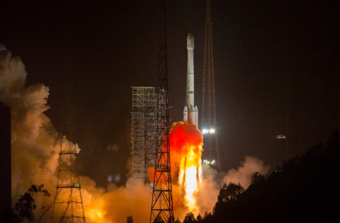
China successfully launched a new navigation satellite, Beidou-44, on April 20, 2019. The launch took place from the LC3 Launch Complex of the Xichang Satellite Launch Center, Sichuan province, using a Long March-3B/G2 launch vehicle.

The satellite is part of the GEO component of the third phase of the Chinese Beidou (Compass) satellite navigation system, using both geostationary satellites and satellites in intermediate orbits.

The satellites feature a phased array antenna for navigation signals, and a laser retroreflector and additionally deployable S/L-band and C-band antennas.

The Beidou Navigation Satellite System (BDS) has been independently constructed, developed and operated by China taking into account the needs of the country’s national security, economic and social development.