Tuesday, April 18th, 2017
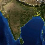
NASA recently released new global nighttime images of the Earth, including a detailed view of India and its surroundings that show how patterns of human settlement changed across the country between 2012 and 2016. Satellite images of...

Tuesday, January 24th, 2017
The $4 billion geospatial industry in India is expected to become a $20 billion market by 2025, growing at a cumulative annual rate of 12-15 percent. According to M. Venkaiah Naidu, Union Minister of Urban Development, Housing...

Tuesday, August 23rd, 2016
A new analysis of satellite images shows that nearly 30 percent of India’s agricultural land is turning into desert, and the rate of soil degradation is increasing at an alarming rate. The report by the Indian Space...
Tuesday, July 7th, 2015
3D imagery of buildings and terrain of India's major cities, including Rashtrapati Bhavan and PMO, could soon be seen in Google Earth with the government contemplating to give permission for uploading pictures of the country's metropolitan areas. Home...
Thursday, July 2nd, 2015
The Zoological Survey of India (ZSI) has drawn a year-long plan for its centenary year. The organisation, which completed 100 years on Wednesday, will unveil sculptures and hold discussions with the aim of generating awareness on conservation...
Thursday, July 2nd, 2015
Prime Minister Narendra Modi will kicks off his Digital India project in Indore with a video conference. The initiative will connect 10 village panchayats with high-speed internet service starting tomorrow. Work to connect 335 village panchayats with high-speed...