Asian Surveying & Mapping
Breaking News
HAL to build, market Isro’s SSLV in landmark deal
New Delhi, Jun 20: In a historic move for...
Taiwan developing space capabilities for all-weather imaging
TAIPEI (TVBS News) — Taiwan is advancing its space...
Honda hails successful test of reusable rocket as it looks to get into the space business
Tokyo — Japan's second-biggest carmaker, Honda, has successfully tested...
China’s space program provides larger platform for broader international cooperation
BEIJING -- Experts from China's manned space program said...
India To Launch $1.5 Billion Joint Earth Mission With NASA In July
National Aeronautics and Space Administration (NASA) and the Indian...
Axiom-4 mission delayed again: ISRO confirms Subhanshu Shukla’s ISS spaceflight won’t launch before 22 June 2025
The Axiom-4 mission to the International Space Station has...
Mengzhou spacecraft for China’s moon-landing mission passes landmark test flight
China has completed the inaugural test flight of its...
Space application for ITMA Asia + CITME 2026 opens
Shanghai – Space application for the 2026 edition of...
Yanmar, Chia Tai and XAG Empower Thai Agriculture through Innovation
Bang Nam Priao District, Chachoengsao Province, Thailand – On...
bitsensing Signs MOU with IKIO Technologies to Advance AI-Based Traffic Monitoring on India’s Expressways, Highways and Municipal Areas
Backed by proven success in South Korea and Europe,...

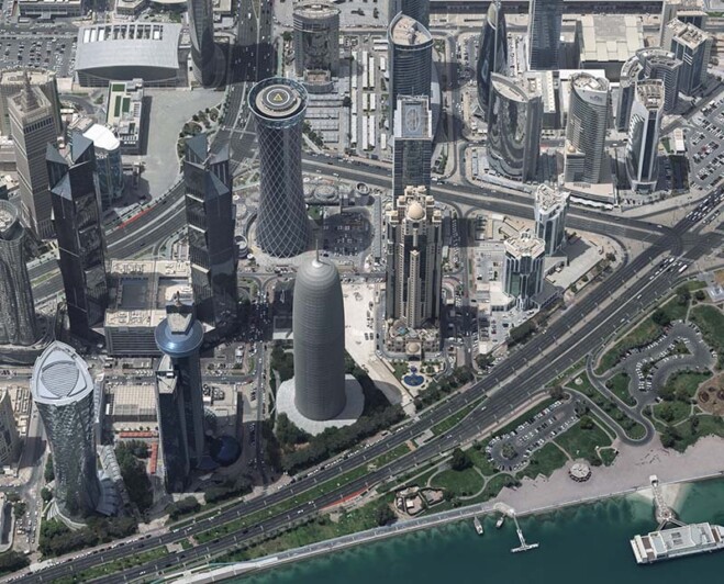
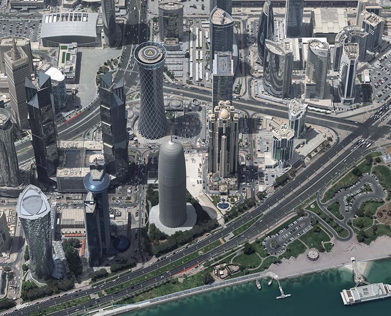
The Centre for Geographic Information Systems (CGIS), the official geospatial agency of the State of Qatar, successfully delivered the country’s first advanced, vectorized, watertight 3D city model of Doha.   

CGIS collected, in collaboration with Khatib & Alami, aerial data using Vexcel Imaging’s UltraCam Osprey 4.1—a large-format photogrammetric camera system capturing both nadir and oblique imagery—and processed it with Vexcel’s UltraMap software suite. High-quality, watertight Level of Detail (LOD) 2 and LOD3 models were then generated using advanced tools from RhinoTerrain and DAT/EM Systems International, demonstrating how cutting-edge technologies and strategic collaboration can shape the future of smart cities. 

The final deliverable spans 218 square kilometers across 16 designated urban areas, resulting in 43,310 LOD2 buildings and 300 LOD3 buildings. The textured, watertight models conform to CityGML standards, ensuring compatibility and seamless integration into modern GIS platforms. 

This initiative enhances urban planning, infrastructure management and digital twin development, while also improving disaster preparedness and spatial analysis through a custom Esri-based image viewer. 

Image Credit: Vexcel Imaging