Asian Surveying & Mapping
Breaking News
Space42 and ICEYE Announce Joint Venture to Bring Satellite Manufacturing to the UAE
ABU DHABI, UAE —  Space42 (ADX: SPACE42), a UAE-based...
Australia and UK tie up for navigation without GNSS
Airborne navigation without GNSS is the aim of a...
Market size, technical gaps threaten Taiwan’s space dream
As global players like SpaceX dominate headlines, Taiwan is...
China quietly tested its first inflatable space module in orbit
BREMEN, Germany — China tested out a small expandable...
Isro Signs Agreement with Australian Space Agency for Gaganyaan Mission
Isro Signs Agreement with Australian Space Agency for Gaganyaan...
ESA and Japan expand collaboration in space exploration
The European Space Agency (ESA) and the Japan Aerospace...
Korea’s space development to hit wall without private sector initiative
The private sector should take the initiative in South...
India’s Chandrayaan-2 moon orbiter avoids collision with South Korea’s Danuri spacecraft
India's Chandrayaan-2 moon orbiter maneuvered in September to avoid...
Dubai residents may soon have opportunity to travel to the edge of space
Residents of Dubai may soon have the chance to...
Swift Navigation and KDDI Launch Skylark Precise Positioning Service Across Japan
SAN FRANCISCO and TOKYO - Swift Navigation, a global...

natural disaster

Friday, August 12th, 2011

Economies at Risk from Natural Disasters

Natural mayhem can create havoc not only to human lives, but also to economies. The Recent disaster in Japan vouches for this. Recently  an ‘analysis and mapping’ firm maplecroft released a report stating that emerging economies like India,...

Monday, June 6th, 2011

GIS Proves Key to Flood and Fire Management

Geographic Information System (GIS) technology is the key to reducing the social and economic tolls of flood, fire and extreme weather events, according to Gary Johnson, Esri Australia Principal Consultant for Financial Services, speaking at the Australian...
Tuesday, April 19th, 2011

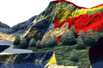
Spatial Data – Key to Landscape Modeling

The ability to analyze, model and simulate natural disaster events and their consequences is unique to the geospatial and geomatics sector. No other tools provide data management, analysis and the associated visual output, useful for decision-making purposes...