Asian Surveying & Mapping
Breaking News
Chinese launch startup’s rocket fails during satellite launch
The Chinese launch company Galactic Energy suffered its first...
First Hong Kong-made satellite set to launch in November from Guangdong province, company reveals
The first Hong Kong-made satellite is set to be...
China launches Yaogan 39 remote sensing satellite
China launched a Long March 2D carrier rocket on...
Saudi Arabia publishes maps with new names for ceded islands
A new map published by Saudi Arabia’s General Authority...
US, Saudi Arabia conclude region’s largest-ever counter-UAS exercise
The US and Saudi Arabia conducted the largest-ever counter-UAS exercise...
Study improves accuracy of planted forest locations in East Asia
An international team led by Purdue University scientists has...
Iran, Russia Working On Joint Research Spacecraft
In an interview with Tasnim, the president of the...
France, Bangladesh sign deal to provide loans, satellite technology during Macron’s visit to Dhaka
French President Emmanuel Macron witnessed the signature of a...
Iran, Russia Working on Joint Research Spacecraft
TEHRAN (Tasnim) – Top universities from Iran and Russia...
India, Vietnam, Malaysia, Philippines and Taiwan reject China’s new ‘controversial’ map, release statements
China continues to receive brute criticism from countries that...

simulation

Friday, February 24th, 2012

What Google’s Patents Reveal About Upcoming High-Tech Glasses

Search giant Google is reportedly gearing up to sell a set of high-tech, computerized glasses — yes, as in spectacles — later this year, according to reports published by The New York Times this week, confirming earlier...

Wednesday, January 11th, 2012

SuperGeo to release SuperGIS Network Analyst 3

SuperGIS Network Analyst 3 is the powerful analysis tool for the control, simulation, design, and planning of various network conditions. Except for finding the shortest path, SuperGIS Network Analyst 3 comprises closest facilities, service area, vehicle routing problem, and...

Thursday, November 24th, 2011

T-FLEX CAD 12 – New Understanding of Productivity

New architectural solutions of T-FLEX CAD 12 provide new opportunities for fast and high quality design. Significant improvements in the latest version accelerate the design process with an optimized technology of parametric assemblies that is helpful for...

Thursday, November 10th, 2011

Bentley Announces Commercial Availability of AECOsim Energy Simulator and AECOsim Building Designer

Bentley Systems, Incorporated today announced the immediate commercial availability of its new AECOsim Energy Simulator software and commercial availability in early Q1 2012 of its new AECOsim Building Designer software (currently in Bentley’s early adopter program). AECOsim Compliance Manager for LEED certification was released...
Tuesday, April 19th, 2011

Spatial Data – Key to Landscape Modeling

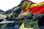
The ability to analyze, model and simulate natural disaster events and their consequences is unique to the geospatial and geomatics sector. No other tools provide data management, analysis and the associated visual output, useful for decision-making purposes...

Monday, March 21st, 2011

Simulation of the Tsunami That Struck Japan

This type of simulation is quite rare. Only researchers from NOAA (U.S. Agency study of the ocean and atmosphere) have carried out such simulations in the days that followed the tsunami.In Europe, UCL is one of the...

Thursday, January 6th, 2011

New SPIRENT GSS6400 GNSS Test

Whether developing navigation algorithms, performing vendor selection, evaluating receiver variants or establishing the performance of a PND under real world conditions you will need a repeatable representative high quality GPS signal. And sometimes testing using real world...