Asian Surveying & Mapping
Breaking News
Intermap Announces $1 Million Program in Malaysia and Business Updates
DENVER – Intermap Technologies (TSX: IMP; OTCQB: ITMSF) (“Intermap” or...
From Kuala Lumpur To Singapore: Malaysia’s High-Speed Rail Resurgence Sparks China’s Pan-Asia Vision
The Malaysian government is once again working on building...
Japan’s Synspective successfully launches fourth SAR satellite
Synspective, the Japanese provider of Satellite/Synthetic Aperture Radar (SAR)...
South Korea’s Joowon Industrial Selects Aeva 4D LiDAR for Automated Power Line Inspection Program
MOUNTAIN VIEW, Calif. & SEONGNAM CITY, South Korea- Aeva®...
Synspective’s SAR Satellite, StriX-3, Successfully Reaches Its Target Orbit and Spreads Its Wings
TOKYO, 2024, March 13 – Synspective Inc., a SAR...
Indian Prime Minister Narendra Modi Commissions Genesys Digital Twin Map Stack in His Parliamentary Constituency
Mumbai: The Prime Minister of India, Mr. Narendra Modi, recently...
Geo Connect Asia 2024 to unveil geospatial’s transformative power
Geo Connect Asia (GCA) is set to return to...
Iran launches ‘domestically developed’ imaging satellite from Russia
The launch of Pars 1 is fourth this year,...
Astranis relocating hobbled debut satellite from Alaska to Asia
TAMPA, Fla. — Astranis is moving its debut satellite...
Asia space race heats up as China, Japan and India reach for the stars
After another year of US aeronautics company SpaceX dominating...

Author Archive

image

Thursday, October 20th, 2011

Borneo Rainforest Monitoring Tool Wins GMES Prize

The European Union's Global Monitoring for Environment and Security (GMES) programme has recently concluded their GMES Ideas Challenge, which awards prizes to the best applications for new uses of earth observation images. The overall winner of this...

Thursday, October 13th, 2011

New Zealand Oil Spill Triggers Aerial Surveillance Charter

The break-up of a stranded cargo ship on the Astrolabe Reef in New Zealand has triggered the International Charter for Space  and Major Disasters. With cracks appearing the hull, and an estimate 1,900 tonnes of oil and...
Wednesday, October 12th, 2011

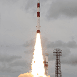
India Launches the Megha-Tropiques Earth Observation Satellite

The Indian Space Research Organisation (ISRO) successfully launched the Megha-Tropiques satellite, along with three micro satellites, aboard their Polar Satellite Launch Vehicle today. The Megha-Tropiques earth observation satellite is an Indo-French Joint Satellite Mission that will study...
Wednesday, October 12th, 2011

Japan Proves a Hotbed for Location-Based Services Growth

Location-based services has been an emerging market for more than ten years, with projected explosive growth worldwide that hasn't matched the hype. While new check-in services, such as Gowalla and Foursquare, were seen as a driver for...

Tuesday, October 11th, 2011

The Continuing Evolution of 3D Cadastre in Asia

Continuing discussion and technological advances with respect to 3D cadastre are changing how cadastre are stored and used. By comparison, 2D cadastre have several disadvantages that updated and improved 3D products and services can provide. Both Nepal...

Friday, October 7th, 2011

Laser Scanning – Advancing 3D

Laser scanning has become increasingly popular from both airborne and terrestrial perspectives. New products are advancing the options for use and enabling the collection of 3D data from varied environments. This poses new challenges, but also solves...

Friday, October 7th, 2011

New HabiMAP Tool Factors Development Impacts to Marine Environments

The Perth, Australia office of international professional and environmental services firm AECOM has developed an new tool to assess the risks to critical marine habitats from development. HabiMAP provides new survey techniques to map and assess animals,...
Friday, September 30th, 2011

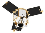
Malaysia Commits to Expanding Satellite Earth Observation Program

The Malaysian government has made a five-year and RM200 million (US$66 million) commitment to extend their RazakSAT earth observation satellite program that began with the launch of RazakSATE-1 on July 14, 2009. The Ministry of Science, Technology...

Page 3 of 28 1 2 3 4 5 6 7 8 28