
Tuesday, March 29th, 2016
Urban areas will play a critical role in achieving sustainable development and combating climate change. Many cities have already taken bold steps to reduce their environmental footprint, and have often been able to do so much more...

Thursday, December 3rd, 2015
PARIS, Dec. 1, 2015—Google Maps and FAO have agreed to work closely together to make geospatial tracking and mapping products more accessible, providing a high-technology assist to countries tackling climate change and much greater capacity to experts...

Thursday, September 10th, 2015
By Mr. Poh Fatt Mak, Business Line Manager (3D Documentation), Asia Pacific, FARO Technologies 3D Documentation is the act of capturing accurate three-dimensional (3D) geometry and images of real objects, reproducible at a certain point in time,...

Thursday, August 13th, 2015
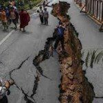
Crowdsourcing has added a new dimension to Nepal’s disaster response capability following the massive earthquake that struck this Himalayan country on 25 April, killing more than 8,000 people, injuring thousands and leaving tens of thousands displaced. Government...
Thursday, August 13th, 2015
Chinese Internet giant Tencent, the maker of WeChat, has pinned down a strategic investment with indoor mapping startup sensewhere. The total amount of the deal was undisclosed, but the companies said that Tencent now has a license...
Thursday, August 13th, 2015
A new study published in the peer-reviewed journal Atmospheric Chemistry and Physics estimates that global sea levels could rise far more quickly than expected: 10 feet within the next 50 years. The paper, now undergoing public review,...

Wednesday, August 12th, 2015
Geographic information about people and the planet is critical to making better decisions and using resources more wisely, and will be vital to achieving the new Sustainable Development Goals that countries have recently agreed on, according to...
Friday, August 7th, 2015
August 7, 2015 — Do you need to capture or update spatial data in the field? QGIS is a free and open source geographic information system, and Discover Spatial is hosting a new course that will take...
Friday, August 7th, 2015
August 7, 2015 — GeoShot Technologies has successfully completed large city modeling using LiDAR data. “We are very excited to complete the first large scale city modeling project at GeoShot Technologies at a time when 3D city...
Friday, August 7th, 2015
Toronto, ON, August 7, 2015 — Avenza Systems Inc., producers of the PDF Maps app for mobile devices and geospatial plug-ins for Adobe Creative Cloud, including Geographic Imager® for Adobe Photoshop®, is pleased to announce the release of...