
PARIS, Dec. 1, 2015—Google Maps and FAO have agreed to work closely together to make geospatial tracking and mapping products more accessible, providing a high-technology assist to countries tackling climate change and much greater capacity to experts developing forest and land-use policies.
Digital technology tapping into satellite imagery is revolutionizing the way countries can assess, monitor and plan the use of their natural resources, including monitoring deforestation and desertification.
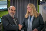
“For FAO, this is not just a partnership. This is a strategic alliance,” said FAO Director-General José Graziano da Silva, noting it combines FAO’s global effort to combat climate change with Google’s commitment to help on the climate data science and awareness fronts.
The three-year partnership between Google Maps and FAO is designed to foster innovation and expertise and sharply broaden access to easy-to-use digital tools. It ushers in a major ramping up of existing collaboration between the two organizations and will boost the visibility and implementation of efforts to encourage sustainable environmental practices around the world.
“This partnership is powerful because it unites the complementary strengths of UN FAO and Google,” said Rebecca Moore, Director, Google Earth, Earth Engine & Earth Outreach. “FAO has decades of hard-won experience working on the ground in hundreds of countries on thousands of projects. Meanwhile, Google technology is at the cutting edge of big data, cloud computing, and transformatively-simple mapping tools. The FAO Collect Earth application brilliantly builds on top of Google Earth and Earth Engine to provide a simple but powerful global and national forest carbon monitoring tool, empowering countries as diverse as Chile, Panama, Namibia, Papua New Guinea, Tunisia and Bhutan. We look forward to further strengthening this partnership in support of global climate action and sustainable development.”
Concretely, Google Maps will provide 1,200 trusted tester credentials on Google Earth Engine to FAO staff and partners, while also providing training and receiving feedback on users’ needs and experiences.
FAO will train its own staff and technical experts in member countries, upon their requests,, to use free and open source software tools developed within its Open Foris Initiative and using Google technology, for example Earth Engine.
The partnership foresees sharing knowledge and identifying needs that will broaden the kind of satellite data collected, broadening the focus to monitoring drylands and agricultural crop productivity.
Fast and user friendly
Monitoring forest cover and land-use change is destined to become increasingly important as countries around the world adopt measures to adapt to and mitigate climate change.
Open Foris tools have been developed with financial support from the governments of Finland, Germany and Norway. They help countries to obtain more detailed information about their own forest and natural resources in a more efficient manner than was possible before.
“Satellite images and products that used to take days to download and process can now be produced and visualized in a fraction of that time ” said Giulio Marchi, a forestry officer at the UN agency.
With the help of Google Earth Outreach, the technology company’s “Geo for Good” division, the Google Earth Engine has been made available through FAO’s Open Foris Collect Earth tool, which has been designed to make it easy even for people without prior remote-sensing experience to track land-use patterns and their changes over time and is already being deployed in more than 30 countries.
FAO’s Forest Assessment Management and Conservation Division has already trained hundreds of people around the world to use the tool in sample-based land cover assessments.
Basically, users can specify the kind of information they want to track, which is then sought among a vast set of remote sensing images of different resolutions, including a hefty archive of Landsat images dating back to 1972. Point-and-click methods allow users to zoom in on small areas and compare them to the same areas in the past.
For example, these images ( Image 1, Image 2 and Image 3) show the interface of Collect Earth together with Google Earth Engine to visualize the development of new crop fields in former grasslands along the Orange River in South Africa.
While remote sensing data often needs to be accompanied by “ground truth” information obtained locally, the result allows for closer monitoring of variables ranging from tree cover to greenhouse gas emissions.
