Asian Surveying & Mapping
Breaking News
South Korea is converting an abandoned coal mine into a moon exploration testing ground
South Korea is transforming abandoned coal mines into testing...
ISRO to Launch Chandrayaan-5 With Japan, Plans Space Station
Dr. V. Narayanan, Chairman of the Indian Space Research...
Russia and China are threatening SpaceX’s Starlink satellite constellation, new report finds
SpaceX's Starlink satellite constellation is facing threats from Russia...
China and Pakistan agree to fly 1st foreign astronaut to Chinese space station
For the first time, the Chinese space program will train...
ISRO’s “Space on Wheels” offers a peek into Indian Space Programme to students in Karimnagar
The Indian Space Research Organisation (ISRO)’s “Space on Wheels”...
Geospatial led solutions build the foundations for better decision-making
Geo Connect Asia 2025 paves the way for turning...
GEOSA, Singapore Land Authority Launch Achievements of Joint Geospatial System Project
Riyadh, SPA -- The General Authority for Survey and...
Building in Bangkok collapses as powerful earthquake hits southeast Asia
One person has died and 50 were injured in...
Bellatrix Aerospace Partners with Astroscale Japan for Space Debris Removal
Bellatrix Aerospace, a Bengaluru-based space mobility company, has joined...
NSTC announces Pingtung site as Taiwan’s space mission launch center
Taipei, March 26 (CNA) Taiwan's National Science and Technology...
resourcesat

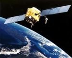
Resourcesat-2 is a 1,206-kg satellite with three pushbroom multispectral scanners. The satellite also carries additional equipment called AIS (Automatic Information System) from COMDEV, Canada, for the surveillance of ships in the VHF band to derive their position and speed. The cameras are tuned for measuring agricultural crops, crop acreage/yield estimations, precision farming, water resources, forest mapping, rural infrastructure development, and disaster management.. ResourceSat-2 provides continuity and increases the observation times in tandem with ResourceSat-1, which was launched in 2003.

India now has ten remote sensing satellites in orbit, including Resourcesat 1, TES, Cartosat 1, 2, 2A and 2B, IMS-1, RISAT-2, and Oceansat-2. This data is used for a variety of measurements to aid policy direction. Imagery sales from ISRO satellites are also responsible for considerable revenues for teh country as it delivers imagery in a variety of spatial resolutions, spectral bands, and swath widths across the globe.

The spacecraft control centre in Bangalore is continuously monitoring returns from the satellite, with the help of the ISTRAC network of ground stations at Bangalore, Lucknow, Mauritius, Biak in Indonesia, Svalbard in Norway and Troll in Antartica. The satellite is expected to start delivering images on April 28.