Sunday, June 12th, 2011
The Russian Academy of Sciences has offered support and assistance to Turkmenistan in creating a national satellite monitoring centre. The offer was made in the Russian Academy of Sciences’ section of the international exhibition “Science, Hardware and Innovative...
Saturday, June 11th, 2011
On behalf of the Asian Association on Remote Sensing (AARS), I would like to welcome you all to the 32nd Asian Conference on Remote Sensing (ACRS) to be held in Taipei from October 3 to 7, 2011....
Monday, June 6th, 2011
Former President of India A P J Abdul Kalam Thursday suggested that Indian Space Research Organisation (ISRO) build a satellite service station in geo-synchronous orbit as he saw an opportunity for it in this field. Kalam, himself an...
Wednesday, June 1st, 2011
MacDonald, Dettwiler and Associates Ltd. (TSX: MDA), a provider of essential information solutions, announced today that RADARSAT-2 information will be used by the Government of Russia to enhance their ability to provide critical information to support disaster...
Tuesday, May 31st, 2011
RapidEye announced today that Cambodia and Laos-based Aruna Technology is now part of its growing
distribution network. As part of the agreement, Aruna's territory will be Vietnam, Laos, Cambodia, Thailand and Myanmar. John Ahlrichs, Vice President of Distributor Sales at...
Wednesday, May 25th, 2011
MacDonald, Dettwiler and Associates Ltd. has signed a contract for $2.5 million (CAD) with ScanEx Research and Development Center (ScanEx) to provide RADARSAT data information to multiple ground stations in Russia over three years. The information will be used by Russian...
Wednesday, May 18th, 2011
JAXA had been trying to communicate with the Advanced Land Observing Satellite “DAICHI” (ALOS) for about three weeks after its power generation anomaly on April 22, but we decided to complete its operations by sending a command...

Friday, May 6th, 2011
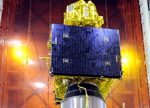
Recently India launched the Resourcesat-2 satellite, a satellite designed to provide detailed information about the earth's resources and surface - a 'global workhorse' as R.R. Navalgund, Director, Space Applications Centre (SAC), Ahmedabad said. Meanwhile, this week has...
Monday, April 25th, 2011
The Japan Aerospace Exploration Agency (JAXA) has been operating the Advanced Land Observing Satellite ‘DAICHI” (ALOS), which has exceeded its design life of three years and its target life of five years. However, at around 7:30 a.m....

Thursday, April 21st, 2011
The Indian Space Resource Organization successfully launched the remote sensing satellite Resourcesat-2 and two smaller satellites at 10:12 a.m. on Wednesday. The launch also included Singapore's first remote sensing satellite called X-Sat as well as a mini...