Wednesday, October 19th, 2011
GeoEye, Inc. announced it signed a multi-year enterprise agreement with Google Inc. to license access to Google Earth Builder, Google’s cloud-based map publishing platform. GeoEye is making this investment as part of its strategy to increase online...
Wednesday, October 19th, 2011
Cloud cover has always been a problem for companies that rely on satellite or aerial imagery in tropical locations such as Papua New Guinea, where the ground is obscured for up to 90% of the year. With...

Wednesday, October 12th, 2011
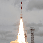
The Indian Space Research Organisation (ISRO) successfully launched the Megha-Tropiques satellite, along with three micro satellites, aboard their Polar Satellite Launch Vehicle today. The Megha-Tropiques earth observation satellite is an Indo-French Joint Satellite Mission that will study...

Friday, September 30th, 2011
The Malaysian government has made a five-year and RM200 million (US$66 million) commitment to extend their RazakSAT earth observation satellite program that began with the launch of RazakSATE-1 on July 14, 2009. The Ministry of Science, Technology...
Saturday, September 24th, 2011
ESA’s Envisat observation satellite yesterday completed its 50 000th circuit of Earth – travelling 2.25 billion km since its launch nearly a decade ago. Envisat orbits our planet every 100 minutes, speeding along at more than seven kilometres...
Thursday, September 1st, 2011
RapidEye Canada Ltd., an affiliate of Iunctus Geomatics Corp., announced today that it has aquired the assets of RapidEye AG of Brandenburg an der Havel, Germany, a global provider of high-resolution imagery and geospatial solutions. The purchase was finalized...
Thursday, September 1st, 2011
Responding quickly and effectively after a disaster has occurred is paramount to reducing injuries and saving lives, preventing property loss and mitigating further damage. Today, geospatial imagery and ENVI image analysis software are used to provide timely,...
Wednesday, August 31st, 2011
On 26 July 2011, GISTDA hosts the Workshop on Cooperative Project on the Establishment of ASEAN Earth Observation Satellite at Siam Bayshore Spa and Resort, Pattaya, Chonburi Province. The aim of the workshop is to discuss view...

Friday, August 19th, 2011
Turkey successfully launched the RASAT earth observation satellite this week. RASAT is a microsatellite imaging mission of TUBITAK-UZAY (Scientific and Technological Research Council of Turkey). It is expected that the satellite will help to provide information for disaster...
Wednesday, August 17th, 2011
RASAT, the first observation satellite designed and produced by Turkish engineers, will be launched into space on Wednesday, from the Yasny Launch Base, located in a southwestern Russian oblast bordering Kazakhstan. RASAT was designed, manufactured and tested...