Asian Surveying & Mapping
Breaking News
HAL to build, market Isro’s SSLV in landmark deal
New Delhi, Jun 20: In a historic move for...
Taiwan developing space capabilities for all-weather imaging
TAIPEI (TVBS News) — Taiwan is advancing its space...
Honda hails successful test of reusable rocket as it looks to get into the space business
Tokyo — Japan's second-biggest carmaker, Honda, has successfully tested...
China’s space program provides larger platform for broader international cooperation
BEIJING -- Experts from China's manned space program said...
India To Launch $1.5 Billion Joint Earth Mission With NASA In July
National Aeronautics and Space Administration (NASA) and the Indian...
Axiom-4 mission delayed again: ISRO confirms Subhanshu Shukla’s ISS spaceflight won’t launch before 22 June 2025
The Axiom-4 mission to the International Space Station has...
Mengzhou spacecraft for China’s moon-landing mission passes landmark test flight
China has completed the inaugural test flight of its...
Space application for ITMA Asia + CITME 2026 opens
Shanghai – Space application for the 2026 edition of...
Yanmar, Chia Tai and XAG Empower Thai Agriculture through Innovation
Bang Nam Priao District, Chachoengsao Province, Thailand – On...
bitsensing Signs MOU with IKIO Technologies to Advance AI-Based Traffic Monitoring on India’s Expressways, Highways and Municipal Areas
Backed by proven success in South Korea and Europe,...

Earth Observation

Wednesday, February 29th, 2012

Morgan and Claypool Announce Availability of Remote Sensing Image Processing Book

Earth observation is the science of modeling and monitoring of the processes on the surface of the planet and their interaction with the Earth’s atmosphere. The planet is constantly monitored using state-of-the-art radar and optical sensors. The...

Wednesday, January 11th, 2012

Preparations Under Way for IGARSS 2012

Jointly organised by the IEEE Geoscience and Remote Sensing Society, the DLR German Aerospace Center and ESA, the 2012 International Geoscience and Remote Sensing Symposium (IGARSS) is scheduled to be held 22–27 July in Munich, Germany. IGARSS...
Wednesday, January 4th, 2012

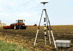
Precision Agriculture:’The Right time, the Right Amount and the Right Place’

Higher commodity prices are resulting in higher bottom lines for many agricultural producers today. Productive agricultural land is no longer readily available, and a growing global population increasingly depends upon technological innovation to meet consumer needs. As...

Monday, January 2nd, 2012

Remote Sensing for Cane Cultivation

Until not too long ago, Government of India and the sugar industry manually estimated the area under sugarcane cultivation. This system involved the collection of estimates from the field and the compilation of data.  That system had...

Sunday, December 25th, 2011

First Pléiades 1A Imagery Released

Pléiades 1A returns its first images 3 days after being placed in orbit by a Soyuz launch vehicle on December 17, 2011. Several extracts are now available to the public. Extracts of the first images acquired by the Pléiades...

Thursday, December 8th, 2011

ESA Selects Astrium to Build Sentinel-5 Precursor Satellite

Furthering Europe’s capacity to monitor atmospheric pollution, ESA has awarded a contract worth €45.5 million to Astrium UK to act as prime contractor for the Sentinel-5 Precursor satellite system.

Wednesday, December 7th, 2011

RapidEye:Third Coverage of China Contracted by the MLR

RapidEye announced today that it has signed a contract with China’s Ministry of Land and Resources (MLR) to cover almost five million square kilometers of China over the next few months. This is the third consecutive year that RapidEye was a...

Thursday, December 1st, 2011

China Successfully Launches Remote-sensing Satellite

China successfully launched a remote-sensing satellite on Wednesday that it says will be used to conduct scientific experiments, carry out surveys on land resources, monitor crop yields and help with natural disaster prevention and response. Called Yaogan XIII,...

Thursday, November 10th, 2011
Sharper DMCii Satellite Images Guide Farmers Worldwide

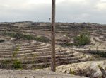
In the two years since DMCii added 22m multispectral imagery to its geospatial data portfolio, the...

Thursday, October 20th, 2011

Borneo Rainforest Monitoring Tool Wins GMES Prize

The European Union's Global Monitoring for Environment and Security (GMES) programme has recently concluded their GMES Ideas Challenge, which awards prizes to the best applications for new uses of earth observation images. The overall winner of this...

Page 4 of 10 1 2 3 4 5 6 7 8 9 10