Tuesday, November 1st, 2011
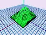
A local 3D software firm creating interactive images of cities has received a capital injection from the ICE Angels investment group. Auckland-based Nextspace has been developing software since 2007 but the latest focus of the 12-man operation has...
Thursday, October 27th, 2011
It was a thrill to host the first outdoor 3D projection mapping fashion show in the Philippines, a breakthrough from P&G and Ariel in partnership with Bench at the SMX open grounds in front of Microtel, SM Mall of...
Tuesday, September 27th, 2011
Paolo Nespoli spent 6 months on-board the International Space Station from Dec 2010 through to May 2011. In this video he shot using ESA's Erasmus Recording Binocular (ERB-2) stereoscopic camera during various phases of his MagISStra mission,...

Thursday, September 22nd, 2011
As the world of 3D expands and grows, the role of the printer is adapting to meet the challenge. While most 3D spatial data is usually maintained within a digital environment and managed within software, a 3D...
Thursday, September 22nd, 2011
3D Systems Corporation announced today that it acquired Formero Pty, Ltd., a leading provider of on-demand custom parts services and 3D printing solutions headquartered in Melbourne, Australia. The company plans to continue all Formero operations as 3D...

Thursday, September 8th, 2011
Singapore's Urban Redevelopment Authority (URA) has won the prestigious Exemplary Systems in Government (ESIG) award from the Urban and Regional Information Systems Association (URISA). The URA Digital 3D Urban Model System garnered praise because it was built...

Thursday, September 8th, 2011
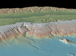
Hyderabad-based Indian National Centre for Ocean Information Services (INCOIS) has started work on multi-hazard vulnerability mapping of the country's entire coastline. The mapping effort aims to inform authorities of vulnerable areas so that they can adequately prepare...
Tuesday, September 6th, 2011
Seiko Epson Corporation announced that it has launched the world's first high-temperature polysilicon ("HTPS") TFT liquid crystal panels for 3D 3LCD projectors. Developed and manufactured by Epson using the latest processing technologies, the HTPS panels employ 'Bright 3D Drive'...
Tuesday, September 6th, 2011
A new release of SectionTools plugin is now available with the latest Rhino 5.0 Beta or later. You can find download links and documentation at SectionTools wiki page.

Thursday, August 25th, 2011
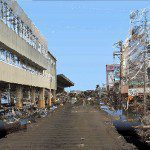
StreetMapper, the vehicle-based laser mapping system, is being used to assess the damage caused by the Japanese earthquake of the 11th March 2011. The mobile mapping system, purchased from Mirukuru and operated by Asia Air Survey, has...