Asian Surveying & Mapping
Breaking News
South Korea partially suspends inter-Korean agreement over North’s spy satellite
SEOUL, South Korea -- South Korea said North Korea fired...
Chinese software firm inks deal with Kenya to boost geospatial technology cooperation
Chinese technology firm, Supermap International, signed an agreement with...
Survey of India, Genesys International Sign MoU to Develop ‘Digital Twins’ Of Indian Cities
Genesys International, India’s home-grown geospatial mapping company and Survey...
UAE Space Agency leads first Space Pavilion participation at COP28
DUBAI - The UAE Space Agency is leading the...
ISRO, NASA likely to launch remote sensing satellite in 1st half of ’24
NEW DELHI: If everything goes as per plan, India...
IBM Advances Geospatial AI to Address Climate Challenges
YORKTOWN HEIGHTS, N.Y.- IBM (NYSE: IBM) today announced new...
Australia Greenlights Game-Changing Era: Commercial Drones with ParaZero Safety Systems to Fly
ParaZero is thrilled to be at the forefront of...
Asia’s top satellite operator aims to launch solar energy forecast system in Europe
Japan’s satellite titan SKY Perfect JSAT aims to expand...
Japan to set up $6.7bn JAXA fund to develop space industry
TOKYO -- Japan's cabinet on Monday approved a bill...
China launches a satellite to compete with Elon Musk’s Starlink
This was stated by Business Insider, citing a report...

hydrology

Monday, September 12th, 2011

Australia’s Seasonal Streamflow Forecasts

Near median flows are the most likely outcome for eighteen of the forecast sites for spring, with high flows most likely for the remaining sites. Conditions in the tropical Pacific Ocean remain neutral and close to average...

Wednesday, August 31st, 2011

Trimble Introduces Complete Drainage Solution for Agricultural Water Management

Trimble introduced today its new drainage solution for agricultural water management. The Trimble WM-Drain solution is designed to assist farmers or contractors throughout the entire drainage workflow,...

Thursday, August 25th, 2011

OGC Seeks Participants for Hydrologic Forecasting Interoperability

The Open Geospatial Consortium (OGC) invites participation in a Hydrologic Forecasting Interoperability Experiment (IE). This activity, which will begin on September 22, 2011, is designed to advance the development of WaterML 2.0 and test its use in...
Wednesday, August 24th, 2011

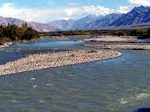
Finding the Source: Brahmaputra, Indus, Salween and Irrawaddy Rivers

The source of the Brahmaputra, Indus, Salween and Irrawaddy rivers was reported this week from scientists at the Chinese Academy of Sciences (CAS). Using satellite imagery, Liu Shaochuang, a researcher with the Institute of Remote Sensing Applications at CAS reported...

Tuesday, August 16th, 2011

City Needs $673m for Flood Control, irrigation

The HCM City People's Committee has asked the Government to allocate more funds to 16 flood-control and irrigation projects due for completion in 2015. It also sought approval to mobilise funds for these projects, which are estimated to...

Friday, May 20th, 2011

Bentley Institute Press – New Guide to Water Loss Reduction

Bentley Institute Press, publisher of cutting-edge university textbooks and professional reference works for the architectural, engineering, construction (AEC), geospatial, owner-operator, and educational communities, announced the release of its newest title,Water Loss Reduction.

Tuesday, April 12th, 2011

Hydrological and Meteorological Equipment Handed – Nepal Kailash Sacred Landscape

Dr. Nirmal H. Rajbhandari, Director General, Department of Department of Hydrology and Meteorology of the Government of Nepal, received hydrological and meteorological equipment worth two crore Nepalese Rupees from Dr Andreas Schild, Director General of ICIMOD, under...